You are here: Home > Network List > CI - Caltech Regional Seismic Network Stations List
> Station GLA Glamis, Glamis, CA, USA > Earthquake Result Viewer
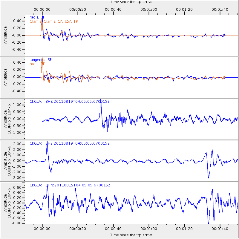
GLA Glamis, Glamis, CA, USA - Earthquake Result Viewer
*The percent match for this event was below the threshold and hence no stack was calculated.
| Earthquake location: |
Fiji Islands Region |
| Earthquake latitude/longitude: |
-16.5/-177.0 |
| Earthquake time(UTC): |
2011/08/19 (231) 03:54:26 GMT |
| Earthquake Depth: |
408 km |
| Earthquake Magnitude: |
5.5 MB, 6.2 MW, 6.2 MW |
| Earthquake Catalog/Contributor: |
WHDF/NEIC |
|
| Network: |
CI Caltech Regional Seismic Network |
| Station: |
GLA Glamis, Glamis, CA, USA |
| Lat/Lon: |
33.05 N/114.83 W |
| Elevation: |
610 m |
|
| Distance: |
77.1 deg |
| Az: |
49.629 deg |
| Baz: |
240.478 deg |
| Ray Param: |
$rayparam |
*The percent match for this event was below the threshold and hence was not used in the summary stack. |
|
| Radial Match: |
79.720345 % |
| Radial Bump: |
400 |
| Transverse Match: |
61.86733 % |
| Transverse Bump: |
400 |
| SOD ConfigId: |
410809 |
| Insert Time: |
2012-01-06 07:42:10.838 +0000 |
| GWidth: |
2.5 |
| Max Bumps: |
400 |
| Tol: |
0.001 |
|
Signal To Noise
| Channel | StoN | STA | LTA |
| CI:GLA: :BHZ:20110819T04:05:05.670015Z | 8.317423 | 1.2508856E-6 | 1.503934E-7 |
| CI:GLA: :BHN:20110819T04:05:05.670015Z | 3.381443 | 3.3494018E-7 | 9.9052436E-8 |
| CI:GLA: :BHE:20110819T04:05:05.670015Z | 4.678501 | 5.06592E-7 | 1.0828083E-7 |
| Arrivals |
| Ps | |
| PpPs | |
| PsPs/PpSs | |


