You are here: Home > Network List > CI - Caltech Regional Seismic Network Stations List
> Station MPM Manuel Prospect Mine, California, USA > Earthquake Result Viewer
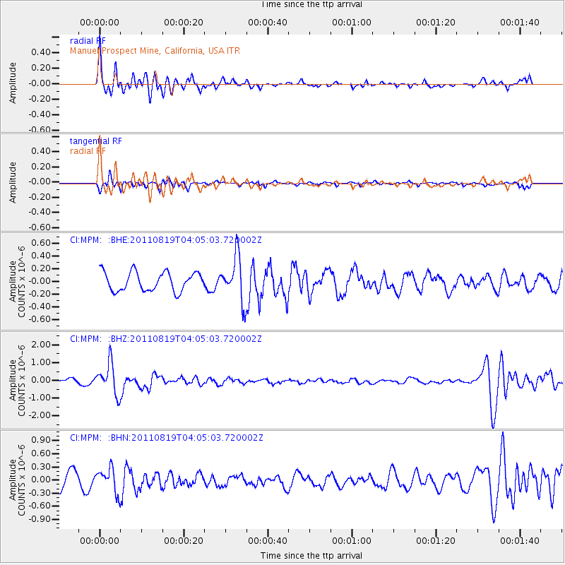
MPM Manuel Prospect Mine, California, USA - Earthquake Result Viewer
*The percent match for this event was below the threshold and hence no stack was calculated.
| Earthquake location: |
Fiji Islands Region |
| Earthquake latitude/longitude: |
-16.5/-177.0 |
| Earthquake time(UTC): |
2011/08/19 (231) 03:54:26 GMT |
| Earthquake Depth: |
408 km |
| Earthquake Magnitude: |
5.5 MB, 6.2 MW, 6.2 MW |
| Earthquake Catalog/Contributor: |
WHDF/NEIC |
|
| Network: |
CI Caltech Regional Seismic Network |
| Station: |
MPM Manuel Prospect Mine, California, USA |
| Lat/Lon: |
36.06 N/117.49 W |
| Elevation: |
185 m |
|
| Distance: |
76.8 deg |
| Az: |
45.831 deg |
| Baz: |
238.117 deg |
| Ray Param: |
$rayparam |
*The percent match for this event was below the threshold and hence was not used in the summary stack. |
|
| Radial Match: |
74.85064 % |
| Radial Bump: |
400 |
| Transverse Match: |
56.374363 % |
| Transverse Bump: |
380 |
| SOD ConfigId: |
410809 |
| Insert Time: |
2012-01-06 07:44:12.585 +0000 |
| GWidth: |
2.5 |
| Max Bumps: |
400 |
| Tol: |
0.001 |
|
Signal To Noise
| Channel | StoN | STA | LTA |
| CI:MPM: :BHZ:20110819T04:05:03.720002Z | 6.7307444 | 9.028461E-7 | 1.3413764E-7 |
| CI:MPM: :BHN:20110819T04:05:03.720002Z | 1.6872509 | 2.804553E-7 | 1.6622027E-7 |
| CI:MPM: :BHE:20110819T04:05:03.720002Z | 2.4726267 | 3.628198E-7 | 1.4673456E-7 |
| Arrivals |
| Ps | |
| PpPs | |
| PsPs/PpSs | |


