You are here: Home > Network List > CI - Caltech Regional Seismic Network Stations List
> Station TUQ Turquiose Mountain, Baker, CA, USA > Earthquake Result Viewer
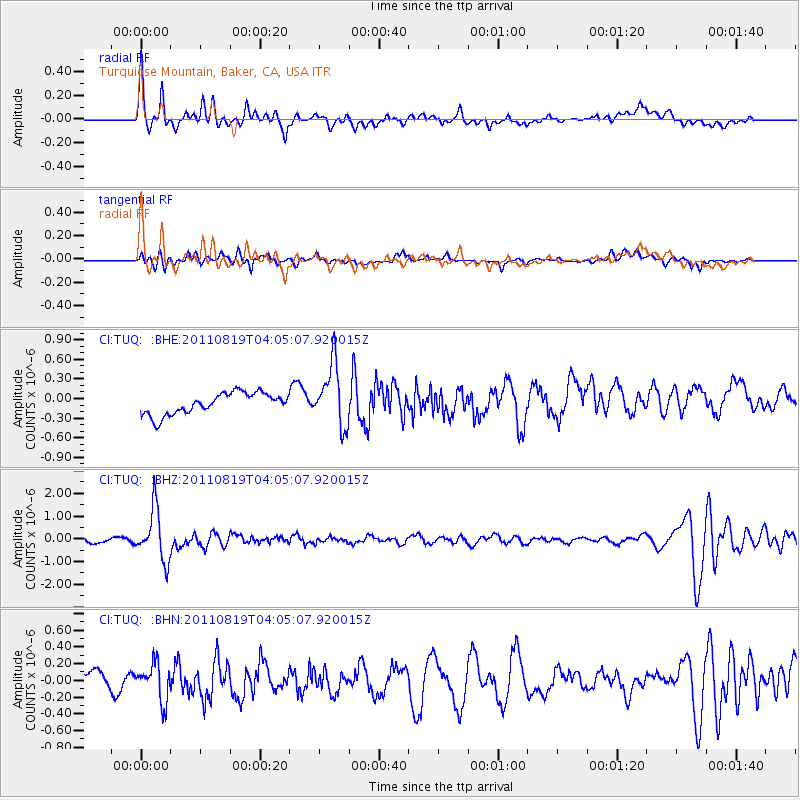
TUQ Turquiose Mountain, Baker, CA, USA - Earthquake Result Viewer
*The percent match for this event was below the threshold and hence no stack was calculated.
| Earthquake location: |
Fiji Islands Region |
| Earthquake latitude/longitude: |
-16.5/-177.0 |
| Earthquake time(UTC): |
2011/08/19 (231) 03:54:26 GMT |
| Earthquake Depth: |
408 km |
| Earthquake Magnitude: |
5.5 MB, 6.2 MW, 6.2 MW |
| Earthquake Catalog/Contributor: |
WHDF/NEIC |
|
| Network: |
CI Caltech Regional Seismic Network |
| Station: |
TUQ Turquiose Mountain, Baker, CA, USA |
| Lat/Lon: |
35.44 N/115.92 W |
| Elevation: |
1350 m |
|
| Distance: |
77.5 deg |
| Az: |
47.054 deg |
| Baz: |
239.299 deg |
| Ray Param: |
$rayparam |
*The percent match for this event was below the threshold and hence was not used in the summary stack. |
|
| Radial Match: |
73.508766 % |
| Radial Bump: |
400 |
| Transverse Match: |
52.522717 % |
| Transverse Bump: |
400 |
| SOD ConfigId: |
410809 |
| Insert Time: |
2012-01-06 07:46:16.212 +0000 |
| GWidth: |
2.5 |
| Max Bumps: |
400 |
| Tol: |
0.001 |
|
Signal To Noise
| Channel | StoN | STA | LTA |
| CI:TUQ: :BHZ:20110819T04:05:07.920015Z | 9.146538 | 1.1256919E-6 | 1.2307302E-7 |
| CI:TUQ: :BHN:20110819T04:05:07.920015Z | 1.680452 | 2.2168726E-7 | 1.3192121E-7 |
| CI:TUQ: :BHE:20110819T04:05:07.920015Z | 2.9015691 | 4.7333575E-7 | 1.6313096E-7 |
| Arrivals |
| Ps | |
| PpPs | |
| PsPs/PpSs | |


