You are here: Home > Network List > IW - Intermountain West Stations List
> Station MOOW Moose Ponds, Wyoming, USA > Earthquake Result Viewer
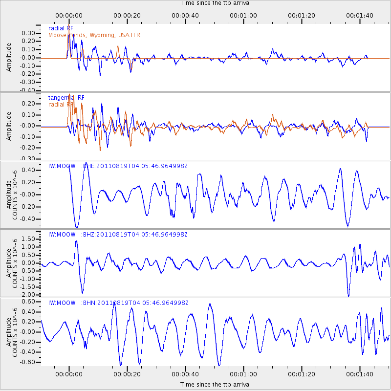
MOOW Moose Ponds, Wyoming, USA - Earthquake Result Viewer
*The percent match for this event was below the threshold and hence no stack was calculated.
| Earthquake location: |
Fiji Islands Region |
| Earthquake latitude/longitude: |
-16.5/-177.0 |
| Earthquake time(UTC): |
2011/08/19 (231) 03:54:26 GMT |
| Earthquake Depth: |
408 km |
| Earthquake Magnitude: |
5.5 MB, 6.2 MW, 6.2 MW |
| Earthquake Catalog/Contributor: |
WHDF/NEIC |
|
| Network: |
IW Intermountain West |
| Station: |
MOOW Moose Ponds, Wyoming, USA |
| Lat/Lon: |
43.75 N/110.74 W |
| Elevation: |
2128 m |
|
| Distance: |
85.1 deg |
| Az: |
41.743 deg |
| Baz: |
241.794 deg |
| Ray Param: |
$rayparam |
*The percent match for this event was below the threshold and hence was not used in the summary stack. |
|
| Radial Match: |
57.74259 % |
| Radial Bump: |
361 |
| Transverse Match: |
54.751324 % |
| Transverse Bump: |
398 |
| SOD ConfigId: |
410809 |
| Insert Time: |
2012-01-06 07:50:09.468 +0000 |
| GWidth: |
2.5 |
| Max Bumps: |
400 |
| Tol: |
0.001 |
|
Signal To Noise
| Channel | StoN | STA | LTA |
| IW:MOOW: :BHZ:20110819T04:05:46.964998Z | 4.367098 | 8.529696E-7 | 1.9531726E-7 |
| IW:MOOW: :BHN:20110819T04:05:46.964998Z | 0.7620834 | 1.3740673E-7 | 1.8030406E-7 |
| IW:MOOW: :BHE:20110819T04:05:46.964998Z | 0.5983985 | 1.357267E-7 | 2.2681655E-7 |
| Arrivals |
| Ps | |
| PpPs | |
| PsPs/PpSs | |


