DRV Dumont d'Urville, Terre Adelie (Antartica) - Earthquake Result Viewer
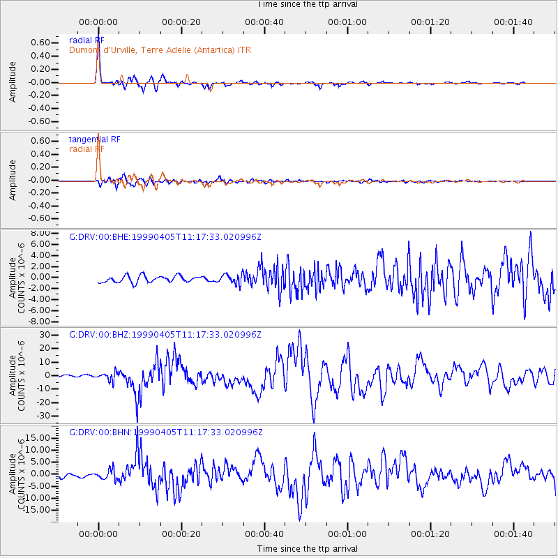
Earthquake location: New Britain Region, P.N.G.
Earthquake latitude/longitude: -5.6/149.6
Earthquake time(UTC): 1999/04/05 (095) 11:08:04 GMT
Earthquake Depth: 150 km
Earthquake Magnitude: 6.2 MB, 7.0 MS, 7.4 MW, 7.3 ME
Earthquake Catalog/Contributor: WHDF/NEIC
Network: G GEOSCOPE
Station: DRV Dumont d'Urville, Terre Adelie (Antartica)
Lat/Lon: 66.67 S/140.01 E
Elevation: 40 m
Distance: 61.3 deg
Az: 184.323 deg
Baz: 10.857 deg
Ray Param: 0.060502708
Estimated Moho Depth: 22.5 km
Estimated Crust Vp/Vs: 1.62
Assumed Crust Vp: 6.39 km/s
Estimated Crust Vs: 3.956 km/s
Estimated Crust Poisson's Ratio: 0.19
Radial Match: 97.26148 %
Radial Bump: 310
Transverse Match: 87.80147 %
Transverse Bump: 400
SOD ConfigId: 4480
Insert Time: 2010-02-26 22:06:33.240 +0000
GWidth: 2.5
Max Bumps: 400
Tol: 0.001

Signal To Noise

ChannelStoNSTALTA
G:DRV:00:BHZ:19990405T11:17:33.020996Z4.48581742.962953E-66.605157E-7
G:DRV:00:BHN:19990405T11:17:33.020996Z3.1114782.0142222E-66.473522E-7
G:DRV:00:BHE:19990405T11:17:33.020996Z1.45217578.6043343E-75.925133E-7
Arrivals
Ps2.3 SECOND
PpPs8.8 SECOND
PsPs/PpSs11 SECOND