You are here: Home > Network List > TA - USArray Transportable Network (new EarthScope stations) Stations List
> Station W35A Tecumseh, OK, USA > Earthquake Result Viewer
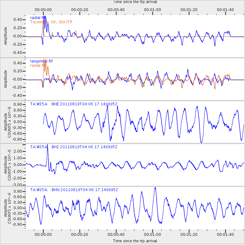
W35A Tecumseh, OK, USA - Earthquake Result Viewer
*The percent match for this event was below the threshold and hence no stack was calculated.
| Earthquake location: |
Fiji Islands Region |
| Earthquake latitude/longitude: |
-16.5/-177.0 |
| Earthquake time(UTC): |
2011/08/19 (231) 03:54:26 GMT |
| Earthquake Depth: |
408 km |
| Earthquake Magnitude: |
5.5 MB, 6.2 MW, 6.2 MW |
| Earthquake Catalog/Contributor: |
WHDF/NEIC |
|
| Network: |
TA USArray Transportable Network (new EarthScope stations) |
| Station: |
W35A Tecumseh, OK, USA |
| Lat/Lon: |
35.15 N/96.87 W |
| Elevation: |
322 m |
|
| Distance: |
91.6 deg |
| Az: |
53.863 deg |
| Baz: |
250.976 deg |
| Ray Param: |
$rayparam |
*The percent match for this event was below the threshold and hence was not used in the summary stack. |
|
| Radial Match: |
78.4695 % |
| Radial Bump: |
400 |
| Transverse Match: |
64.29867 % |
| Transverse Bump: |
383 |
| SOD ConfigId: |
410809 |
| Insert Time: |
2012-01-06 08:04:38.600 +0000 |
| GWidth: |
2.5 |
| Max Bumps: |
400 |
| Tol: |
0.001 |
|
Signal To Noise
| Channel | StoN | STA | LTA |
| TA:W35A: :BHZ:20110819T04:06:17.149995Z | 3.1244955 | 9.289978E-7 | 2.973273E-7 |
| TA:W35A: :BHN:20110819T04:06:17.149995Z | 1.2326454 | 3.66312E-7 | 2.971755E-7 |
| TA:W35A: :BHE:20110819T04:06:17.149995Z | 1.1390501 | 3.3580633E-7 | 2.9481262E-7 |
| Arrivals |
| Ps | |
| PpPs | |
| PsPs/PpSs | |


