You are here: Home > Network List > TA - USArray Transportable Network (new EarthScope stations) Stations List
> Station Y37A Hugo, OK, USA > Earthquake Result Viewer
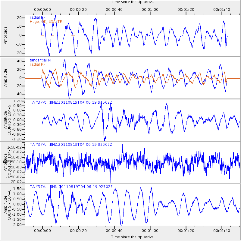
Y37A Hugo, OK, USA - Earthquake Result Viewer
*The percent match for this event was below the threshold and hence no stack was calculated.
| Earthquake location: |
Fiji Islands Region |
| Earthquake latitude/longitude: |
-16.5/-177.0 |
| Earthquake time(UTC): |
2011/08/19 (231) 03:54:26 GMT |
| Earthquake Depth: |
408 km |
| Earthquake Magnitude: |
5.5 MB, 6.2 MW, 6.2 MW |
| Earthquake Catalog/Contributor: |
WHDF/NEIC |
|
| Network: |
TA USArray Transportable Network (new EarthScope stations) |
| Station: |
Y37A Hugo, OK, USA |
| Lat/Lon: |
33.98 N/95.62 W |
| Elevation: |
165 m |
|
| Distance: |
92.2 deg |
| Az: |
55.304 deg |
| Baz: |
251.637 deg |
| Ray Param: |
$rayparam |
*The percent match for this event was below the threshold and hence was not used in the summary stack. |
|
| Radial Match: |
25.50995 % |
| Radial Bump: |
348 |
| Transverse Match: |
31.318058 % |
| Transverse Bump: |
400 |
| SOD ConfigId: |
410809 |
| Insert Time: |
2012-01-06 08:05:42.827 +0000 |
| GWidth: |
2.5 |
| Max Bumps: |
400 |
| Tol: |
0.001 |
|
Signal To Noise
| Channel | StoN | STA | LTA |
| TA:Y37A: :BHZ:20110819T04:06:19.92502Z | 1.1891336 | 5.042452E-9 | 4.2404418E-9 |
| TA:Y37A: :BHN:20110819T04:06:19.92502Z | 1.6222324 | 8.3895605E-7 | 5.171614E-7 |
| TA:Y37A: :BHE:20110819T04:06:19.92502Z | 2.1913915 | 6.1605454E-7 | 2.811248E-7 |
| Arrivals |
| Ps | |
| PpPs | |
| PsPs/PpSs | |


