You are here: Home > Network List > TA - USArray Transportable Network (new EarthScope stations) Stations List
> Station 139A Bunkhouse Ranch, Marshall, TX, USA > Earthquake Result Viewer
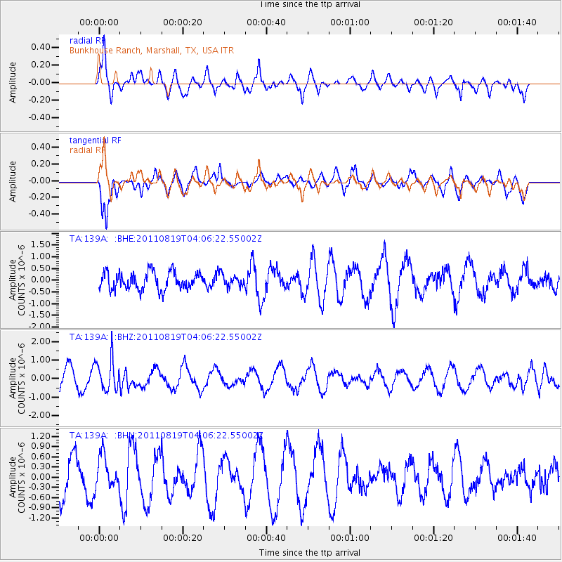
139A Bunkhouse Ranch, Marshall, TX, USA - Earthquake Result Viewer
*The percent match for this event was below the threshold and hence no stack was calculated.
| Earthquake location: |
Fiji Islands Region |
| Earthquake latitude/longitude: |
-16.5/-177.0 |
| Earthquake time(UTC): |
2011/08/19 (231) 03:54:26 GMT |
| Earthquake Depth: |
408 km |
| Earthquake Magnitude: |
5.5 MB, 6.2 MW, 6.2 MW |
| Earthquake Catalog/Contributor: |
WHDF/NEIC |
|
| Network: |
TA USArray Transportable Network (new EarthScope stations) |
| Station: |
139A Bunkhouse Ranch, Marshall, TX, USA |
| Lat/Lon: |
32.68 N/94.39 W |
| Elevation: |
59 m |
|
| Distance: |
92.7 deg |
| Az: |
56.856 deg |
| Baz: |
252.242 deg |
| Ray Param: |
$rayparam |
*The percent match for this event was below the threshold and hence was not used in the summary stack. |
|
| Radial Match: |
57.519016 % |
| Radial Bump: |
370 |
| Transverse Match: |
64.15819 % |
| Transverse Bump: |
347 |
| SOD ConfigId: |
410809 |
| Insert Time: |
2012-01-06 08:06:04.315 +0000 |
| GWidth: |
2.5 |
| Max Bumps: |
400 |
| Tol: |
0.001 |
|
Signal To Noise
| Channel | StoN | STA | LTA |
| TA:139A: :BHZ:20110819T04:06:22.55002Z | 1.6413707 | 8.351268E-7 | 5.0879845E-7 |
| TA:139A: :BHN:20110819T04:06:22.55002Z | 0.885644 | 4.7014103E-7 | 5.3084653E-7 |
| TA:139A: :BHE:20110819T04:06:22.55002Z | 0.64422905 | 2.3729085E-7 | 3.6833305E-7 |
| Arrivals |
| Ps | |
| PpPs | |
| PsPs/PpSs | |


