You are here: Home > Network List > TA - USArray Transportable Network (new EarthScope stations) Stations List
> Station N34A Lincoln, NE, USA > Earthquake Result Viewer
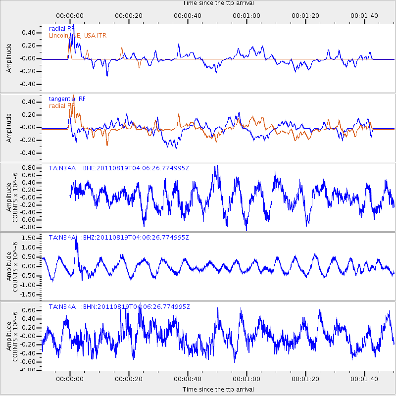
N34A Lincoln, NE, USA - Earthquake Result Viewer
*The percent match for this event was below the threshold and hence no stack was calculated.
| Earthquake location: |
Fiji Islands Region |
| Earthquake latitude/longitude: |
-16.5/-177.0 |
| Earthquake time(UTC): |
2011/08/19 (231) 03:54:26 GMT |
| Earthquake Depth: |
408 km |
| Earthquake Magnitude: |
5.5 MB, 6.2 MW, 6.2 MW |
| Earthquake Catalog/Contributor: |
WHDF/NEIC |
|
| Network: |
TA USArray Transportable Network (new EarthScope stations) |
| Station: |
N34A Lincoln, NE, USA |
| Lat/Lon: |
40.84 N/96.50 W |
| Elevation: |
401 m |
|
| Distance: |
93.7 deg |
| Az: |
48.579 deg |
| Baz: |
251.447 deg |
| Ray Param: |
$rayparam |
*The percent match for this event was below the threshold and hence was not used in the summary stack. |
|
| Radial Match: |
71.43712 % |
| Radial Bump: |
400 |
| Transverse Match: |
54.36627 % |
| Transverse Bump: |
400 |
| SOD ConfigId: |
410809 |
| Insert Time: |
2012-01-06 08:06:42.691 +0000 |
| GWidth: |
2.5 |
| Max Bumps: |
400 |
| Tol: |
0.001 |
|
Signal To Noise
| Channel | StoN | STA | LTA |
| TA:N34A: :BHZ:20110819T04:06:26.774995Z | 2.1305048 | 5.8835195E-7 | 2.7615613E-7 |
| TA:N34A: :BHN:20110819T04:06:26.774995Z | 0.8961534 | 1.9906628E-7 | 2.2213416E-7 |
| TA:N34A: :BHE:20110819T04:06:26.774995Z | 1.885102 | 3.4480078E-7 | 1.829083E-7 |
| Arrivals |
| Ps | |
| PpPs | |
| PsPs/PpSs | |


