You are here: Home > Network List > TA - USArray Transportable Network (new EarthScope stations) Stations List
> Station O40A La Belle, MO, USA > Earthquake Result Viewer
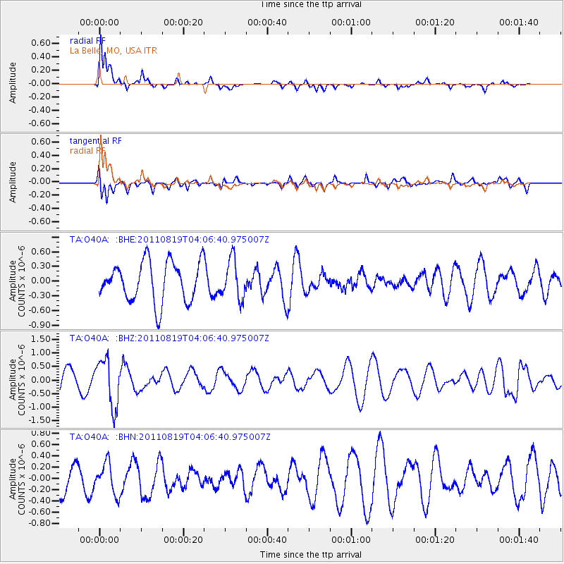
O40A La Belle, MO, USA - Earthquake Result Viewer
*The percent match for this event was below the threshold and hence no stack was calculated.
| Earthquake location: |
Fiji Islands Region |
| Earthquake latitude/longitude: |
-16.5/-177.0 |
| Earthquake time(UTC): |
2011/08/19 (231) 03:54:26 GMT |
| Earthquake Depth: |
408 km |
| Earthquake Magnitude: |
5.5 MB, 6.2 MW, 6.2 MW |
| Earthquake Catalog/Contributor: |
WHDF/NEIC |
|
| Network: |
TA USArray Transportable Network (new EarthScope stations) |
| Station: |
O40A La Belle, MO, USA |
| Lat/Lon: |
40.12 N/91.87 W |
| Elevation: |
206 m |
|
| Distance: |
96.8 deg |
| Az: |
50.31 deg |
| Baz: |
254.281 deg |
| Ray Param: |
$rayparam |
*The percent match for this event was below the threshold and hence was not used in the summary stack. |
|
| Radial Match: |
71.477745 % |
| Radial Bump: |
400 |
| Transverse Match: |
74.82699 % |
| Transverse Bump: |
400 |
| SOD ConfigId: |
410809 |
| Insert Time: |
2012-01-06 08:21:58.516 +0000 |
| GWidth: |
2.5 |
| Max Bumps: |
400 |
| Tol: |
0.001 |
|
Signal To Noise
| Channel | StoN | STA | LTA |
| TA:O40A: :BHZ:20110819T04:06:40.975007Z | 1.7397661 | 8.931796E-7 | 5.1339066E-7 |
| TA:O40A: :BHN:20110819T04:06:40.975007Z | 0.8928564 | 2.8323583E-7 | 3.172244E-7 |
| TA:O40A: :BHE:20110819T04:06:40.975007Z | 1.0103787 | 4.0763018E-7 | 4.0344295E-7 |
| Arrivals |
| Ps | |
| PpPs | |
| PsPs/PpSs | |


