DRV Dumont d'Urville, Terre Adelie (Antartica) - Earthquake Result Viewer
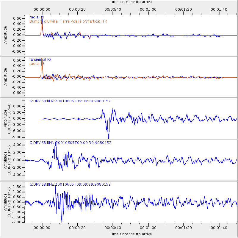
Earthquake location: Eastern New Guinea Reg., P.N.G.
Earthquake latitude/longitude: -6.9/146.4
Earthquake time(UTC): 2001/06/05 (156) 09:00:05 GMT
Earthquake Depth: 10 km
Earthquake Magnitude: 5.8 MB, 6.2 MS, 6.4 MW, 6.1 MW
Earthquake Catalog/Contributor: WHDF/NEIC
Network: G GEOSCOPE
Station: DRV Dumont d'Urville, Terre Adelie (Antartica)
Lat/Lon: 66.67 S/140.01 E
Elevation: 40 m
Distance: 59.8 deg
Az: 182.933 deg
Baz: 7.328 deg
Ray Param: 0.061918873
Estimated Moho Depth: 22.75 km
Estimated Crust Vp/Vs: 1.60
Assumed Crust Vp: 6.39 km/s
Estimated Crust Vs: 3.994 km/s
Estimated Crust Poisson's Ratio: 0.18
Radial Match: 96.91901 %
Radial Bump: 400
Transverse Match: 76.75475 %
Transverse Bump: 400
SOD ConfigId: 4714
Insert Time: 2010-02-26 22:07:09.053 +0000
GWidth: 2.5
Max Bumps: 400
Tol: 0.001

Signal To Noise

ChannelStoNSTALTA
G:DRV:SB:BHN:20010605T09:09:39.908015Z8.1480098.2515356E-71.0127058E-7
G:DRV:SB:BHE:20010605T09:09:39.908015Z1.34484481.8487134E-71.3746667E-7
G:DRV:SB:BHZ:20010605T09:09:39.908015Z8.3410811.4164995E-61.6982206E-7
Arrivals
Ps2.2 SECOND
PpPs8.8 SECOND
PsPs/PpSs11 SECOND