HUMO Hull Mountain, OR - Earthquake Result Viewer
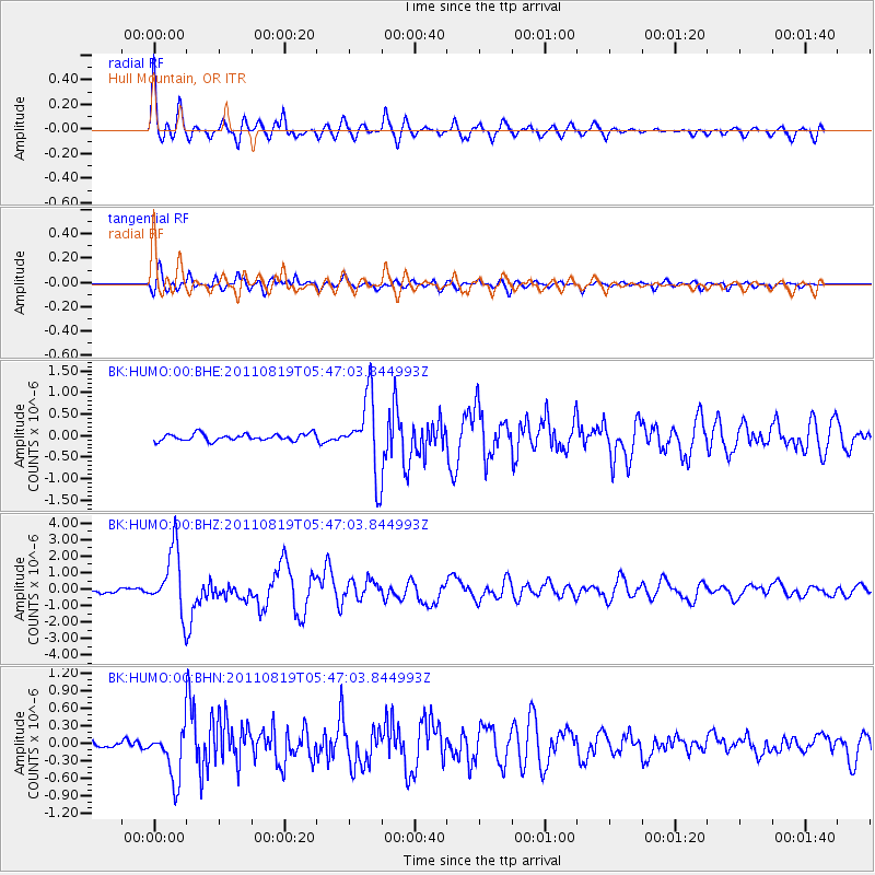
Earthquake location: Near East Coast Of Honshu, Japan
Earthquake latitude/longitude: 37.7/141.7
Earthquake time(UTC): 2011/08/19 (231) 05:36:33 GMT
Earthquake Depth: 47 km
Earthquake Magnitude: 6.3 MB, 5.9 MS, 6.3 MW, 6.3 MW
Earthquake Catalog/Contributor: WHDF/NEIC
Network: BK Berkeley Digital Seismograph Network
Station: HUMO Hull Mountain, OR
Lat/Lon: 42.61 N/122.96 W
Elevation: 555 m
Distance: 69.2 deg
Az: 51.846 deg
Baz: 302.308 deg
Ray Param: 0.055726364
Estimated Moho Depth: 35.0 km
Estimated Crust Vp/Vs: 1.69
Assumed Crust Vp: 6.522 km/s
Estimated Crust Vs: 3.853 km/s
Estimated Crust Poisson's Ratio: 0.23
Radial Match: 91.323814 %
Radial Bump: 400
Transverse Match: 84.6532 %
Transverse Bump: 400
SOD ConfigId: 410809
Insert Time: 2012-01-06 08:40:56.350 +0000
GWidth: 2.5
Max Bumps: 400
Tol: 0.001

Signal To Noise

ChannelStoNSTALTA
BK:HUMO:00:BHZ:20110819T05:47:03.844993Z13.7100181.9045731E-61.3891835E-7
BK:HUMO:00:BHN:20110819T05:47:03.844993Z4.9044164.2927226E-78.75277E-8
BK:HUMO:00:BHE:20110819T05:47:03.844993Z11.0410798.784343E-77.956056E-8
Arrivals
Ps3.9 SECOND
PpPs14 SECOND
PsPs/PpSs18 SECOND