DRV Dumont d'Urville, Terre Adelie (Antartica) - Earthquake Result Viewer
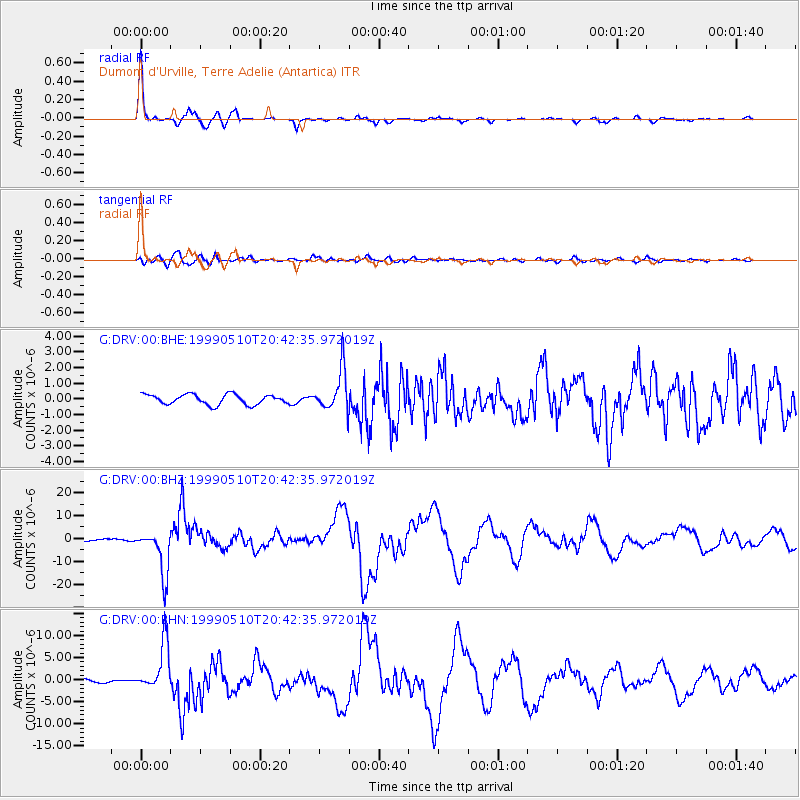
Earthquake location: New Britain Region, P.N.G.
Earthquake latitude/longitude: -5.2/150.9
Earthquake time(UTC): 1999/05/10 (130) 20:33:02 GMT
Earthquake Depth: 138 km
Earthquake Magnitude: 6.5 MB, 6.8 MS, 7.1 MW, 6.5 MB
Earthquake Catalog/Contributor: WHDF/NEIC
Network: G GEOSCOPE
Station: DRV Dumont d'Urville, Terre Adelie (Antartica)
Lat/Lon: 66.67 S/140.01 E
Elevation: 40 m
Distance: 61.9 deg
Az: 184.887 deg
Baz: 12.298 deg
Ray Param: 0.06019514
Estimated Moho Depth: 23.25 km
Estimated Crust Vp/Vs: 1.60
Assumed Crust Vp: 6.39 km/s
Estimated Crust Vs: 3.987 km/s
Estimated Crust Poisson's Ratio: 0.18
Radial Match: 98.10516 %
Radial Bump: 239
Transverse Match: 85.00731 %
Transverse Bump: 400
SOD ConfigId: 4480
Insert Time: 2010-02-26 22:07:37.855 +0000
GWidth: 2.5
Max Bumps: 400
Tol: 0.001

Signal To Noise

ChannelStoNSTALTA
G:DRV:00:BHZ:19990510T20:42:35.972019Z22.7824821.006783E-54.4191106E-7
G:DRV:00:BHN:19990510T20:42:35.972019Z19.4115565.4240977E-62.794262E-7
G:DRV:00:BHE:19990510T20:42:35.972019Z4.0371511.2884103E-63.191385E-7
Arrivals
Ps2.3 SECOND
PpPs9.0 SECOND
PsPs/PpSs11 SECOND