DRV Dumont d'Urville, Terre Adelie (Antartica) - Earthquake Result Viewer
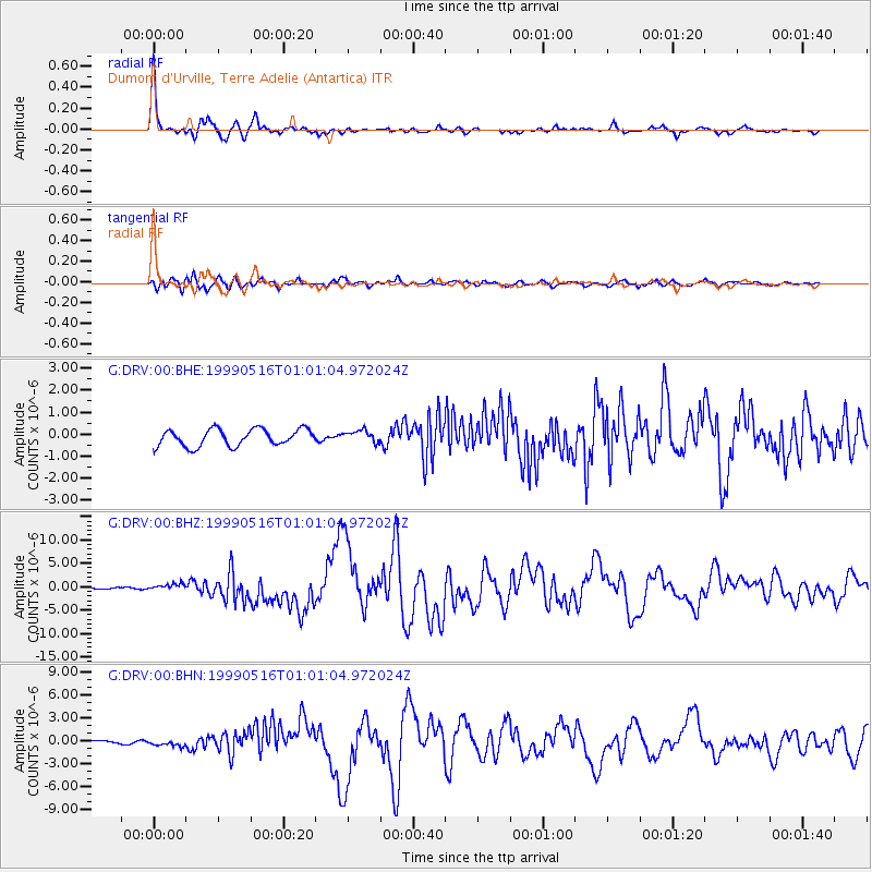
Earthquake location: New Britain Region, P.N.G.
Earthquake latitude/longitude: -4.8/152.5
Earthquake time(UTC): 1999/05/16 (136) 00:51:20 GMT
Earthquake Depth: 74 km
Earthquake Magnitude: 6.0 MB, 7.0 MS, 7.1 MW, 6.3 ME
Earthquake Catalog/Contributor: WHDF/NEIC
Network: G GEOSCOPE
Station: DRV Dumont d'Urville, Terre Adelie (Antartica)
Lat/Lon: 66.67 S/140.01 E
Elevation: 40 m
Distance: 62.4 deg
Az: 185.572 deg
Baz: 14.059 deg
Ray Param: 0.060054734
Estimated Moho Depth: 20.0 km
Estimated Crust Vp/Vs: 1.85
Assumed Crust Vp: 6.39 km/s
Estimated Crust Vs: 3.454 km/s
Estimated Crust Poisson's Ratio: 0.29
Radial Match: 97.25756 %
Radial Bump: 281
Transverse Match: 87.078636 %
Transverse Bump: 400
SOD ConfigId: 4480
Insert Time: 2010-02-26 22:07:47.451 +0000
GWidth: 2.5
Max Bumps: 400
Tol: 0.001

Signal To Noise

ChannelStoNSTALTA
G:DRV:00:BHZ:19990516T01:01:04.972024Z3.92858657.354569E-71.872065E-7
G:DRV:00:BHN:19990516T01:01:04.972024Z1.65660824.7998094E-72.8973716E-7
G:DRV:00:BHE:19990516T01:01:04.972024Z0.734411542.8053904E-73.8199158E-7
Arrivals
Ps2.8 SECOND
PpPs8.6 SECOND
PsPs/PpSs11 SECOND