VTS Vitosha, Bulgary - Earthquake Result Viewer
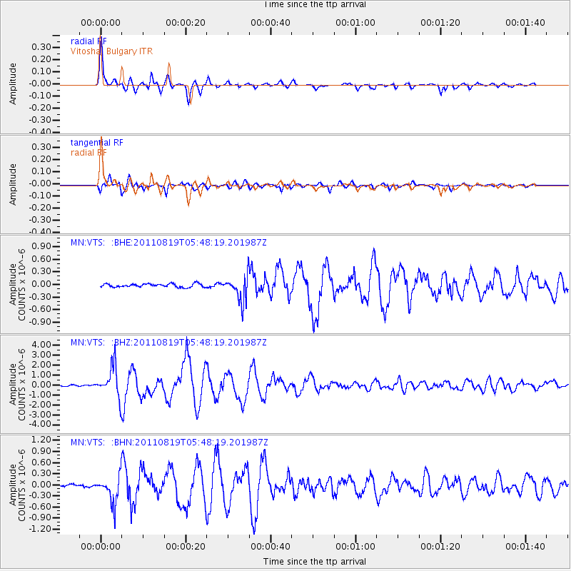
Earthquake location: Near East Coast Of Honshu, Japan
Earthquake latitude/longitude: 37.7/141.7
Earthquake time(UTC): 2011/08/19 (231) 05:36:33 GMT
Earthquake Depth: 47 km
Earthquake Magnitude: 6.3 MB, 5.9 MS, 6.3 MW, 6.3 MW
Earthquake Catalog/Contributor: WHDF/NEIC
Network: MN MEDNET Project
Station: VTS Vitosha, Bulgary
Lat/Lon: 42.62 N/23.24 E
Elevation: 1490 m
Distance: 82.4 deg
Az: 319.086 deg
Baz: 44.752 deg
Ray Param: 0.046817325
Estimated Moho Depth: 36.25 km
Estimated Crust Vp/Vs: 1.84
Assumed Crust Vp: 6.291 km/s
Estimated Crust Vs: 3.424 km/s
Estimated Crust Poisson's Ratio: 0.29
Radial Match: 97.831276 %
Radial Bump: 380
Transverse Match: 97.0355 %
Transverse Bump: 400
SOD ConfigId: 410809
Insert Time: 2012-01-06 08:55:12.852 +0000
GWidth: 2.5
Max Bumps: 400
Tol: 0.001

Signal To Noise

ChannelStoNSTALTA
MN:VTS: :BHZ:20110819T05:48:19.201987Z34.248841.6138563E-64.7121482E-8
MN:VTS: :BHN:20110819T05:48:19.201987Z12.9325323.7416268E-72.8931895E-8
MN:VTS: :BHE:20110819T05:48:19.201987Z7.947143.1702996E-73.989233E-8
Arrivals
Ps4.9 SECOND
PpPs16 SECOND
PsPs/PpSs21 SECOND