TIP Timpagrande, Italy - Earthquake Result Viewer
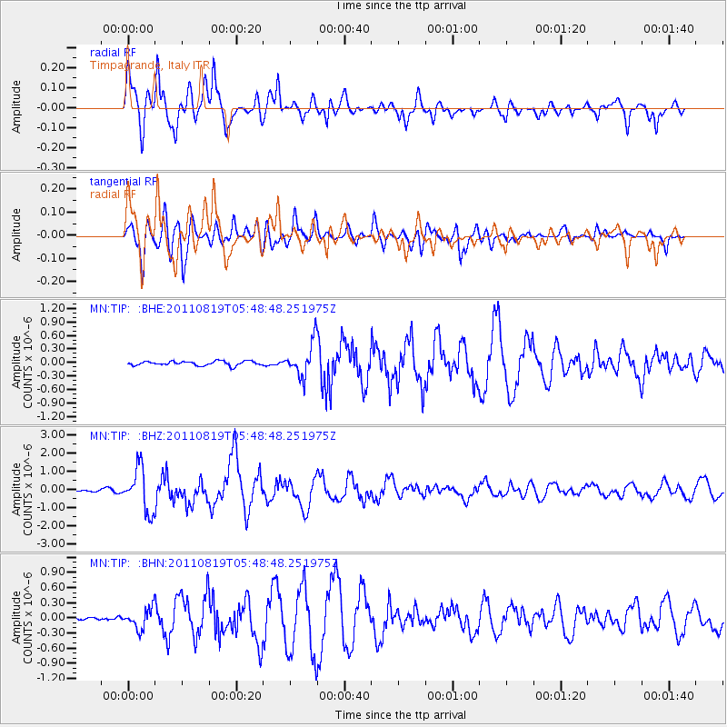
Earthquake location: Near East Coast Of Honshu, Japan
Earthquake latitude/longitude: 37.7/141.7
Earthquake time(UTC): 2011/08/19 (231) 05:36:33 GMT
Earthquake Depth: 47 km
Earthquake Magnitude: 6.3 MB, 5.9 MS, 6.3 MW, 6.3 MW
Earthquake Catalog/Contributor: WHDF/NEIC
Network: MN MEDNET Project
Station: TIP Timpagrande, Italy
Lat/Lon: 39.18 N/16.76 E
Elevation: 789 m
Distance: 88.3 deg
Az: 320.372 deg
Baz: 40.628 deg
Ray Param: 0.042631004
Estimated Moho Depth: 33.0 km
Estimated Crust Vp/Vs: 1.70
Assumed Crust Vp: 6.1 km/s
Estimated Crust Vs: 3.594 km/s
Estimated Crust Poisson's Ratio: 0.23
Radial Match: 94.14422 %
Radial Bump: 400
Transverse Match: 85.42627 %
Transverse Bump: 400
SOD ConfigId: 410809
Insert Time: 2012-01-06 08:55:27.788 +0000
GWidth: 2.5
Max Bumps: 400
Tol: 0.001

Signal To Noise

ChannelStoNSTALTA
MN:TIP: :BHZ:20110819T05:48:48.251975Z19.4451771.2094519E-66.219803E-8
MN:TIP: :BHN:20110819T05:48:48.251975Z4.260372.0772808E-74.8758228E-8
MN:TIP: :BHE:20110819T05:48:48.251975Z7.96708353.814896E-74.7883216E-8
Arrivals
Ps3.9 SECOND
PpPs14 SECOND
PsPs/PpSs18 SECOND