M04C Macdoel, CA, USA - Earthquake Result Viewer
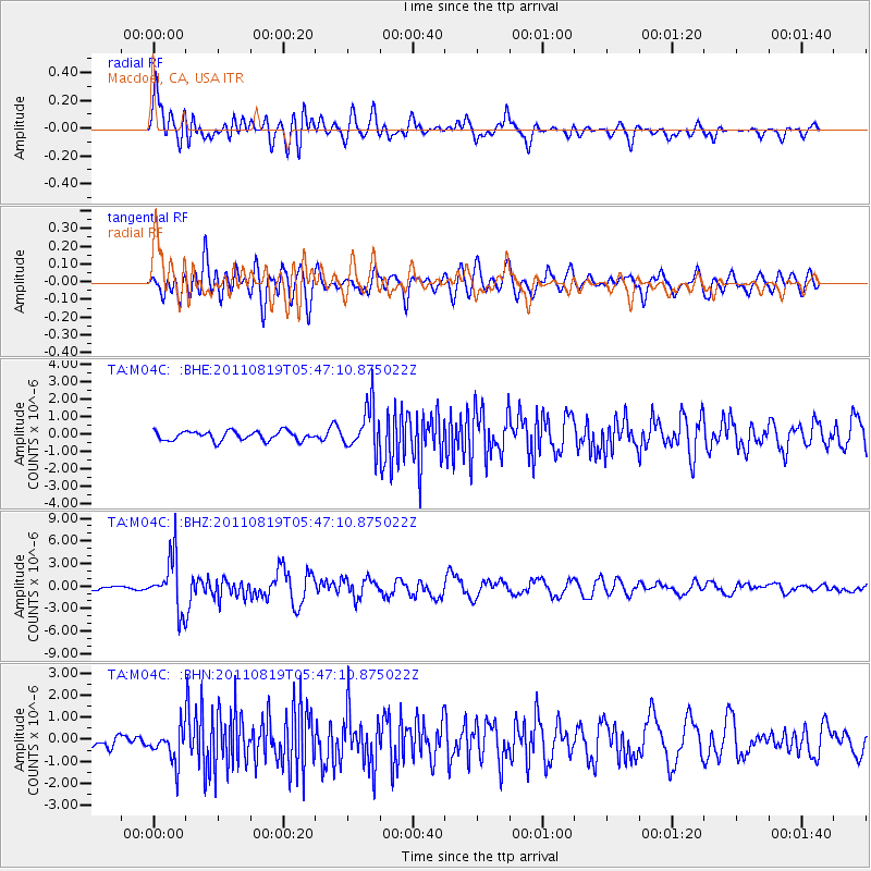
Earthquake location: Near East Coast Of Honshu, Japan
Earthquake latitude/longitude: 37.7/141.7
Earthquake time(UTC): 2011/08/19 (231) 05:36:33 GMT
Earthquake Depth: 47 km
Earthquake Magnitude: 6.3 MB, 5.9 MS, 6.3 MW, 6.3 MW
Earthquake Catalog/Contributor: WHDF/NEIC
Network: TA USArray Transportable Network (new EarthScope stations)
Station: M04C Macdoel, CA, USA
Lat/Lon: 41.78 N/121.84 W
Elevation: 1391 m
Distance: 70.3 deg
Az: 52.106 deg
Baz: 303.146 deg
Ray Param: 0.054967888
Estimated Moho Depth: 44.25 km
Estimated Crust Vp/Vs: 1.71
Assumed Crust Vp: 6.566 km/s
Estimated Crust Vs: 3.845 km/s
Estimated Crust Poisson's Ratio: 0.24
Radial Match: 82.88225 %
Radial Bump: 400
Transverse Match: 76.534096 %
Transverse Bump: 400
SOD ConfigId: 410809
Insert Time: 2012-01-06 09:00:17.693 +0000
GWidth: 2.5
Max Bumps: 400
Tol: 0.001

Signal To Noise

ChannelStoNSTALTA
TA:M04C: :BHZ:20110819T05:47:10.875022Z19.606513.527649E-61.7992232E-7
TA:M04C: :BHN:20110819T05:47:10.875022Z2.5160267.42979E-72.9529863E-7
TA:M04C: :BHE:20110819T05:47:10.875022Z4.74981831.2589608E-62.650545E-7
Arrivals
Ps5.0 SECOND
PpPs18 SECOND
PsPs/PpSs22 SECOND