N23A Red Feather Lakes, CO, USA - Earthquake Result Viewer
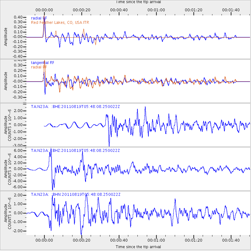
Earthquake location: Near East Coast Of Honshu, Japan
Earthquake latitude/longitude: 37.7/141.7
Earthquake time(UTC): 2011/08/19 (231) 05:36:33 GMT
Earthquake Depth: 47 km
Earthquake Magnitude: 6.3 MB, 5.9 MS, 6.3 MW, 6.3 MW
Earthquake Catalog/Contributor: WHDF/NEIC
Network: TA USArray Transportable Network (new EarthScope stations)
Station: N23A Red Feather Lakes, CO, USA
Lat/Lon: 40.89 N/105.94 W
Elevation: 2458 m
Distance: 80.4 deg
Az: 45.31 deg
Baz: 311.914 deg
Ray Param: 0.048255123
Estimated Moho Depth: 21.25 km
Estimated Crust Vp/Vs: 2.10
Assumed Crust Vp: 6.306 km/s
Estimated Crust Vs: 3.006 km/s
Estimated Crust Poisson's Ratio: 0.35
Radial Match: 88.00105 %
Radial Bump: 400
Transverse Match: 81.23075 %
Transverse Bump: 400
SOD ConfigId: 410809
Insert Time: 2012-01-06 09:02:03.856 +0000
GWidth: 2.5
Max Bumps: 400
Tol: 0.001

Signal To Noise

ChannelStoNSTALTA
TA:N23A: :BHZ:20110819T05:48:08.250022Z17.6554413.2239348E-61.826029E-7
TA:N23A: :BHN:20110819T05:48:08.250022Z6.03319748.6068195E-71.4265768E-7
TA:N23A: :BHE:20110819T05:48:08.250022Z3.97402679.643753E-72.4266953E-7
Arrivals
Ps3.8 SECOND
PpPs10 SECOND
PsPs/PpSs14 SECOND