
J05D Fort Rock, OR, USA - Earthquake Result Viewer
| ||||||||||||||||||
| ||||||||||||||||||
| ||||||||||||||||||
|
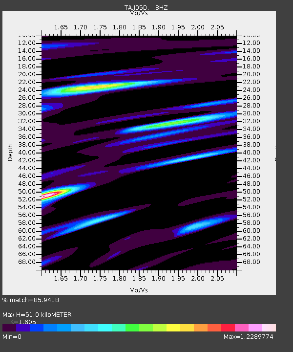
Signal To Noise
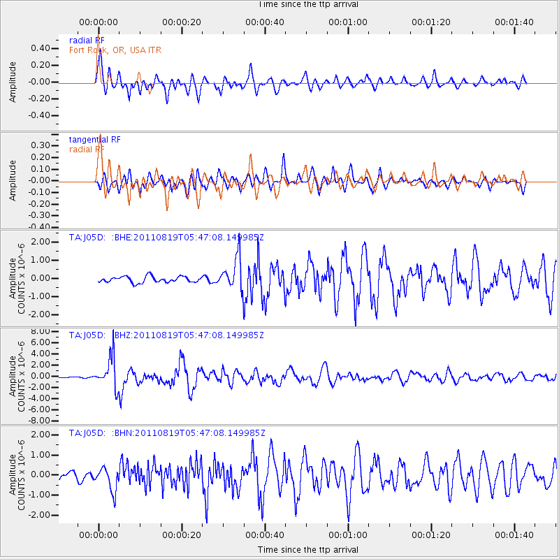
| Channel | StoN | STA | LTA |
| TA:J05D: :BHZ:20110819T05:47:08.149985Z | 14.457661 | 2.885337E-6 | 1.995715E-7 |
| TA:J05D: :BHN:20110819T05:47:08.149985Z | 2.9947824 | 5.942443E-7 | 1.9842653E-7 |
| TA:J05D: :BHE:20110819T05:47:08.149985Z | 5.590777 | 9.223934E-7 | 1.6498484E-7 |
| Arrivals | |
| Ps | 4.9 SECOND |
| PpPs | 19 SECOND |
| PsPs/PpSs | 24 SECOND |

