
DRV Dumont d'Urville, Terre Adelie (Antartica) - Earthquake Result Viewer
| ||||||||||||||||||
| ||||||||||||||||||
| ||||||||||||||||||
|
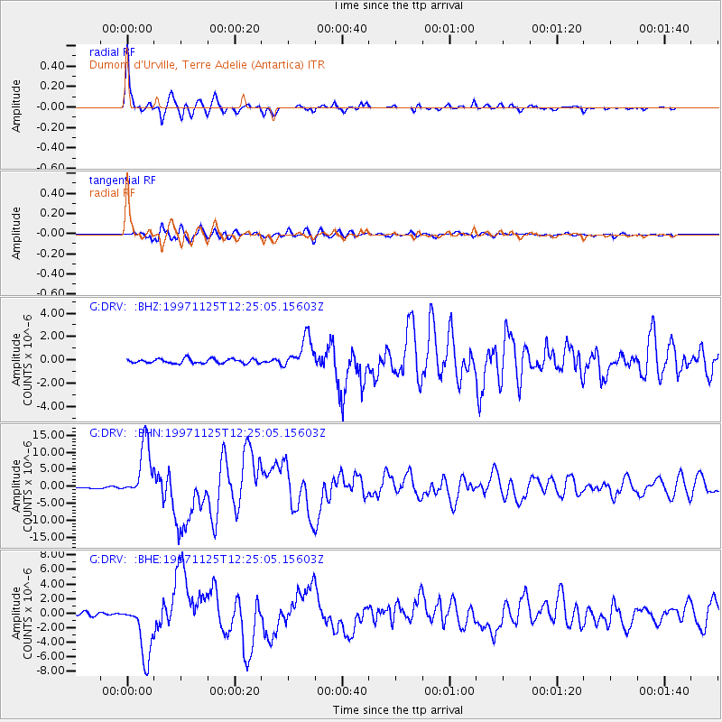
Signal To Noise
| Channel | StoN | STA | LTA |
| G:DRV: :BHN:19971125T12:25:05.15603Z | 50.51136 | 8.328443E-6 | 1.6488258E-7 |
| G:DRV: :BHE:19971125T12:25:05.15603Z | 16.328901 | 4.000232E-6 | 2.4497865E-7 |
| G:DRV: :BHZ:19971125T12:25:05.15603Z | 7.314021 | 1.3660112E-6 | 1.867661E-7 |
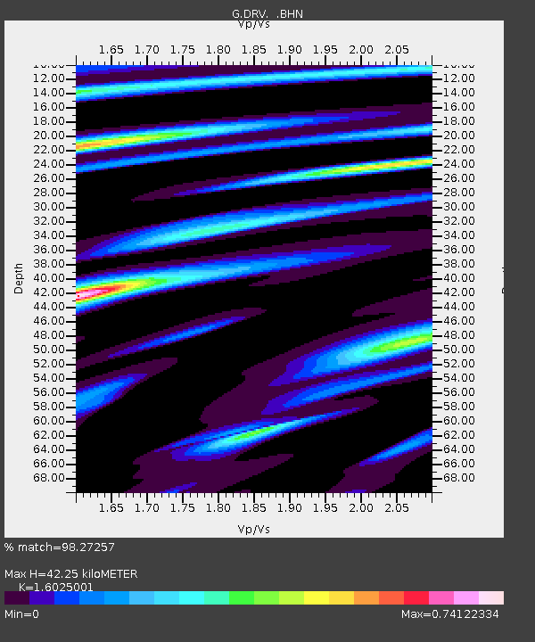
| Arrivals | |
| Ps | 4.2 SECOND |
| PpPs | 17 SECOND |
| PsPs/PpSs | 21 SECOND |

