N02D Trinity Center, CA, USA - Earthquake Result Viewer
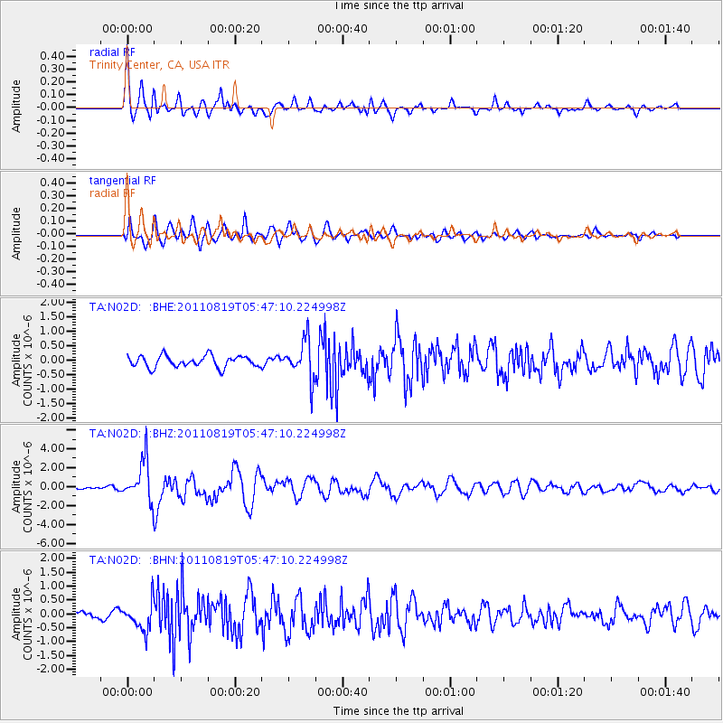
Earthquake location: Near East Coast Of Honshu, Japan
Earthquake latitude/longitude: 37.7/141.7
Earthquake time(UTC): 2011/08/19 (231) 05:36:33 GMT
Earthquake Depth: 47 km
Earthquake Magnitude: 6.3 MB, 5.9 MS, 6.3 MW, 6.3 MW
Earthquake Catalog/Contributor: WHDF/NEIC
Network: TA USArray Transportable Network (new EarthScope stations)
Station: N02D Trinity Center, CA, USA
Lat/Lon: 40.97 N/122.71 W
Elevation: 937 m
Distance: 70.2 deg
Az: 53.203 deg
Baz: 302.946 deg
Ray Param: 0.05503775
Estimated Moho Depth: 24.5 km
Estimated Crust Vp/Vs: 1.75
Assumed Crust Vp: 6.566 km/s
Estimated Crust Vs: 3.757 km/s
Estimated Crust Poisson's Ratio: 0.26
Radial Match: 86.81473 %
Radial Bump: 400
Transverse Match: 83.96483 %
Transverse Bump: 400
SOD ConfigId: 410809
Insert Time: 2012-01-06 09:06:30.438 +0000
GWidth: 2.5
Max Bumps: 400
Tol: 0.001

Signal To Noise

ChannelStoNSTALTA
TA:N02D: :BHZ:20110819T05:47:10.224998Z14.4116482.1874523E-61.5178364E-7
TA:N02D: :BHN:20110819T05:47:10.224998Z3.95878865.1435893E-71.2992837E-7
TA:N02D: :BHE:20110819T05:47:10.224998Z3.39886076.7786766E-71.9943967E-7
Arrivals
Ps2.9 SECOND
PpPs9.9 SECOND
PsPs/PpSs13 SECOND