534A Blanco, TX, USA - Earthquake Result Viewer
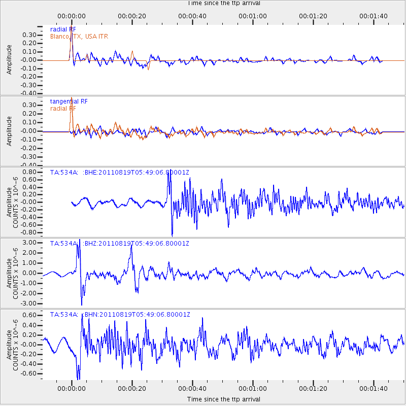
Earthquake location: Near East Coast Of Honshu, Japan
Earthquake latitude/longitude: 37.7/141.7
Earthquake time(UTC): 2011/08/19 (231) 05:36:33 GMT
Earthquake Depth: 47 km
Earthquake Magnitude: 6.3 MB, 5.9 MS, 6.3 MW, 6.3 MW
Earthquake Catalog/Contributor: WHDF/NEIC
Network: TA USArray Transportable Network (new EarthScope stations)
Station: 534A Blanco, TX, USA
Lat/Lon: 30.03 N/98.48 W
Elevation: 461 m
Distance: 92.3 deg
Az: 48.816 deg
Baz: 316.479 deg
Ray Param: 0.04146739
Estimated Moho Depth: 32.0 km
Estimated Crust Vp/Vs: 2.03
Assumed Crust Vp: 6.498 km/s
Estimated Crust Vs: 3.197 km/s
Estimated Crust Poisson's Ratio: 0.34
Radial Match: 83.2223 %
Radial Bump: 400
Transverse Match: 75.7381 %
Transverse Bump: 400
SOD ConfigId: 410809
Insert Time: 2012-01-06 09:07:00.239 +0000
GWidth: 2.5
Max Bumps: 400
Tol: 0.001

Signal To Noise

ChannelStoNSTALTA
TA:534A: :BHZ:20110819T05:49:06.80001Z11.3732741.5481767E-61.361241E-7
TA:534A: :BHN:20110819T05:49:06.80001Z4.7726723.4135638E-77.152311E-8
TA:534A: :BHE:20110819T05:49:06.80001Z5.0502843.7016275E-77.329544E-8
Arrivals
Ps5.2 SECOND
PpPs15 SECOND
PsPs/PpSs20 SECOND