533A Kerrville, TX, USA - Earthquake Result Viewer
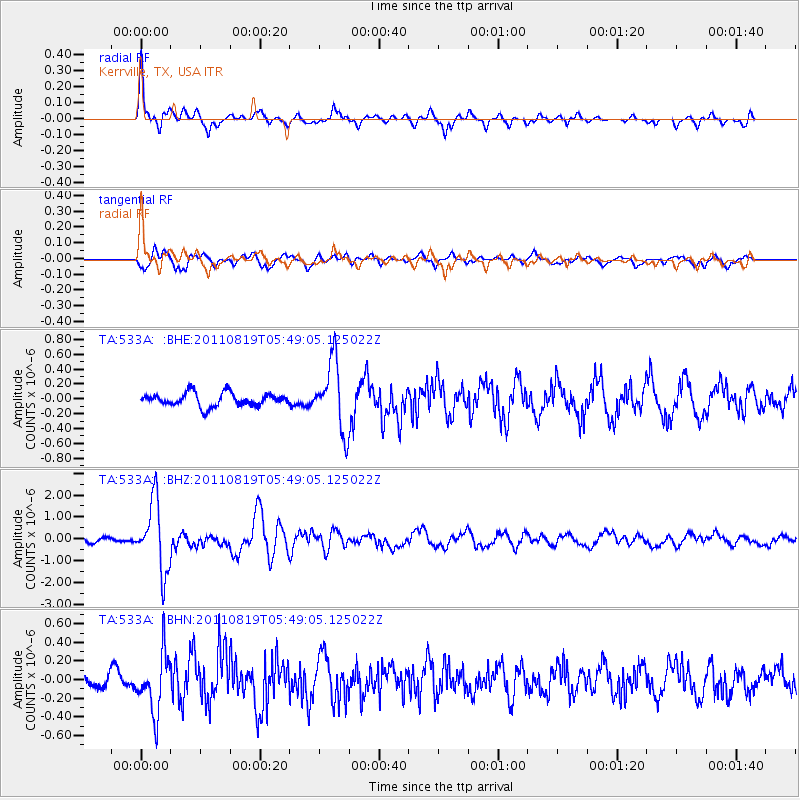
Earthquake location: Near East Coast Of Honshu, Japan
Earthquake latitude/longitude: 37.7/141.7
Earthquake time(UTC): 2011/08/19 (231) 05:36:33 GMT
Earthquake Depth: 47 km
Earthquake Magnitude: 6.3 MB, 5.9 MS, 6.3 MW, 6.3 MW
Earthquake Catalog/Contributor: WHDF/NEIC
Network: TA USArray Transportable Network (new EarthScope stations)
Station: 533A Kerrville, TX, USA
Lat/Lon: 30.07 N/99.04 W
Elevation: 556 m
Distance: 91.9 deg
Az: 49.137 deg
Baz: 316.188 deg
Ray Param: 0.041522916
Estimated Moho Depth: 51.0 km
Estimated Crust Vp/Vs: 1.61
Assumed Crust Vp: 6.498 km/s
Estimated Crust Vs: 4.048 km/s
Estimated Crust Poisson's Ratio: 0.18
Radial Match: 86.63288 %
Radial Bump: 400
Transverse Match: 73.28272 %
Transverse Bump: 400
SOD ConfigId: 410809
Insert Time: 2012-01-06 09:07:02.054 +0000
GWidth: 2.5
Max Bumps: 400
Tol: 0.001

Signal To Noise

ChannelStoNSTALTA
TA:533A: :BHZ:20110819T05:49:05.125022Z12.0343961.584436E-61.3165895E-7
TA:533A: :BHN:20110819T05:49:05.125022Z3.5864073.142962E-78.76354E-8
TA:533A: :BHE:20110819T05:49:05.125022Z5.254954.592103E-78.738623E-8
Arrivals
Ps4.9 SECOND
PpPs20 SECOND
PsPs/PpSs25 SECOND