234A Clairette, TX, USA - Earthquake Result Viewer
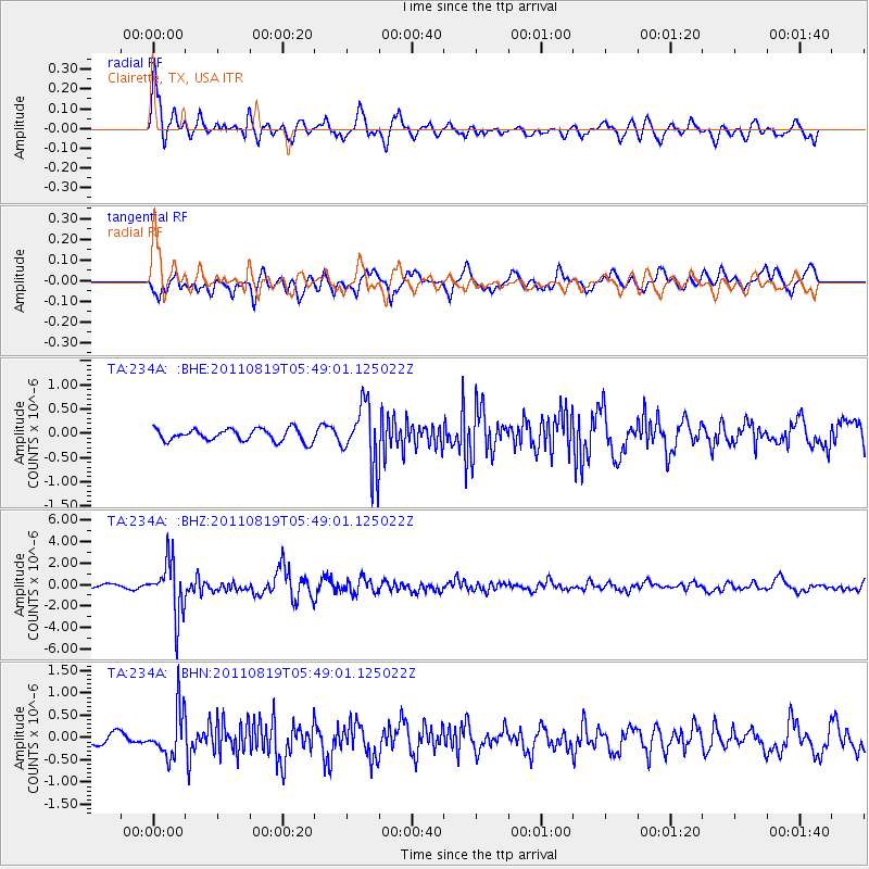
Earthquake location: Near East Coast Of Honshu, Japan
Earthquake latitude/longitude: 37.7/141.7
Earthquake time(UTC): 2011/08/19 (231) 05:36:33 GMT
Earthquake Depth: 47 km
Earthquake Magnitude: 6.3 MB, 5.9 MS, 6.3 MW, 6.3 MW
Earthquake Catalog/Contributor: WHDF/NEIC
Network: TA USArray Transportable Network (new EarthScope stations)
Station: 234A Clairette, TX, USA
Lat/Lon: 32.00 N/98.14 W
Elevation: 358 m
Distance: 91.0 deg
Az: 47.251 deg
Baz: 316.698 deg
Ray Param: 0.041622832
Estimated Moho Depth: 12.25 km
Estimated Crust Vp/Vs: 1.60
Assumed Crust Vp: 6.426 km/s
Estimated Crust Vs: 4.016 km/s
Estimated Crust Poisson's Ratio: 0.18
Radial Match: 82.22483 %
Radial Bump: 400
Transverse Match: 75.42372 %
Transverse Bump: 400
SOD ConfigId: 410809
Insert Time: 2012-01-06 09:08:49.157 +0000
GWidth: 2.5
Max Bumps: 400
Tol: 0.001

Signal To Noise

ChannelStoNSTALTA
TA:234A: :BHZ:20110819T05:49:01.125022Z13.2624012.4968574E-61.8826587E-7
TA:234A: :BHN:20110819T05:49:01.125022Z4.43410355.22508E-71.17838475E-7
TA:234A: :BHE:20110819T05:49:01.125022Z5.153626.421534E-71.2460241E-7
Arrivals
Ps1.2 SECOND
PpPs4.8 SECOND
PsPs/PpSs6.0 SECOND