233A Rising Star, TX, USA - Earthquake Result Viewer
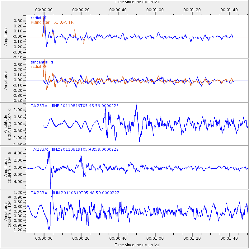
Earthquake location: Near East Coast Of Honshu, Japan
Earthquake latitude/longitude: 37.7/141.7
Earthquake time(UTC): 2011/08/19 (231) 05:36:33 GMT
Earthquake Depth: 47 km
Earthquake Magnitude: 6.3 MB, 5.9 MS, 6.3 MW, 6.3 MW
Earthquake Catalog/Contributor: WHDF/NEIC
Network: TA USArray Transportable Network (new EarthScope stations)
Station: 233A Rising Star, TX, USA
Lat/Lon: 32.02 N/98.90 W
Elevation: 539 m
Distance: 90.6 deg
Az: 47.711 deg
Baz: 316.288 deg
Ray Param: 0.041655373
Estimated Moho Depth: 21.25 km
Estimated Crust Vp/Vs: 1.88
Assumed Crust Vp: 6.426 km/s
Estimated Crust Vs: 3.418 km/s
Estimated Crust Poisson's Ratio: 0.30
Radial Match: 85.20354 %
Radial Bump: 400
Transverse Match: 61.86617 %
Transverse Bump: 400
SOD ConfigId: 410809
Insert Time: 2012-01-06 09:09:00.002 +0000
GWidth: 2.5
Max Bumps: 400
Tol: 0.001

Signal To Noise

ChannelStoNSTALTA
TA:233A: :BHZ:20110819T05:48:59.000022Z13.3326332.3430434E-61.7573748E-7
TA:233A: :BHN:20110819T05:48:59.000022Z3.51971537.256825E-72.0617648E-7
TA:233A: :BHE:20110819T05:48:59.000022Z2.5550625.0885114E-71.9915412E-7
Arrivals
Ps3.0 SECOND
PpPs9.3 SECOND
PsPs/PpSs12 SECOND