O36A Bolckow, MO, USA - Earthquake Result Viewer
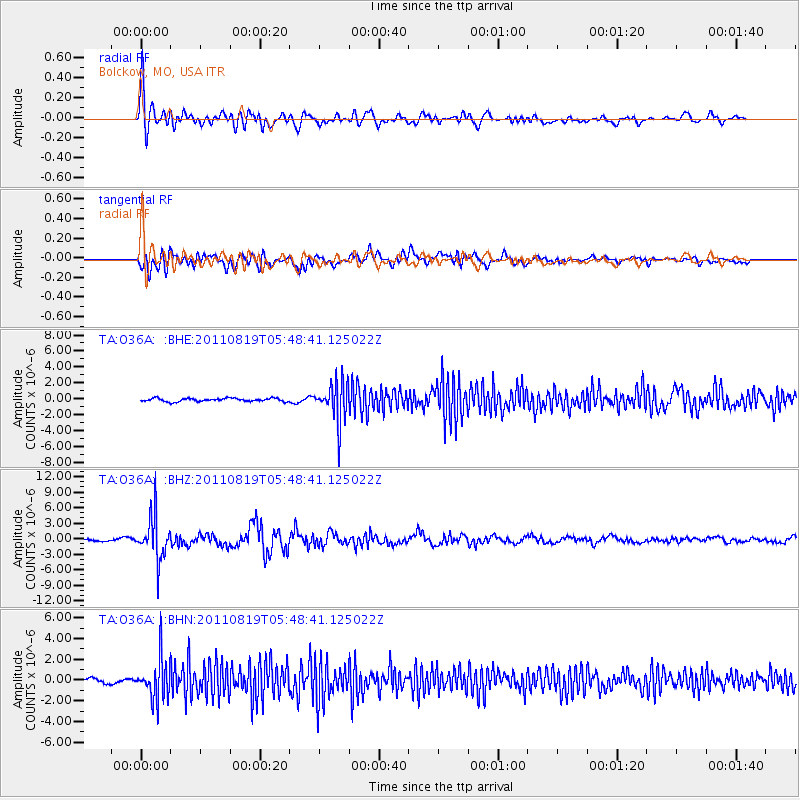
Earthquake location: Near East Coast Of Honshu, Japan
Earthquake latitude/longitude: 37.7/141.7
Earthquake time(UTC): 2011/08/19 (231) 05:36:33 GMT
Earthquake Depth: 47 km
Earthquake Magnitude: 6.3 MB, 5.9 MS, 6.3 MW, 6.3 MW
Earthquake Catalog/Contributor: WHDF/NEIC
Network: TA USArray Transportable Network (new EarthScope stations)
Station: O36A Bolckow, MO, USA
Lat/Lon: 40.13 N/94.96 W
Elevation: 306 m
Distance: 86.8 deg
Az: 39.881 deg
Baz: 318.423 deg
Ray Param: 0.043715894
Estimated Moho Depth: 33.5 km
Estimated Crust Vp/Vs: 1.72
Assumed Crust Vp: 6.498 km/s
Estimated Crust Vs: 3.778 km/s
Estimated Crust Poisson's Ratio: 0.24
Radial Match: 88.63911 %
Radial Bump: 400
Transverse Match: 74.15202 %
Transverse Bump: 400
SOD ConfigId: 410809
Insert Time: 2012-01-06 09:17:01.647 +0000
GWidth: 2.5
Max Bumps: 400
Tol: 0.001

Signal To Noise

ChannelStoNSTALTA
TA:O36A: :BHZ:20110819T05:48:41.125022Z22.9210834.1880794E-61.8271734E-7
TA:O36A: :BHN:20110819T05:48:41.125022Z8.372311.9720085E-62.3553936E-7
TA:O36A: :BHE:20110819T05:48:41.125022Z12.0420952.4804679E-62.0598307E-7
Arrivals
Ps3.8 SECOND
PpPs14 SECOND
PsPs/PpSs17 SECOND