
O33A Hebron, NE, USA - Earthquake Result Viewer
| ||||||||||||||||||
| ||||||||||||||||||
| ||||||||||||||||||
|
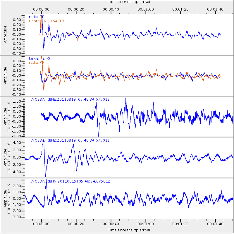
Signal To Noise
| Channel | StoN | STA | LTA |
| TA:O33A: :BHZ:20110819T05:48:34.67501Z | 11.238424 | 2.6054408E-6 | 2.3183328E-7 |
| TA:O33A: :BHN:20110819T05:48:34.67501Z | 3.4932203 | 1.2537594E-6 | 3.589122E-7 |
| TA:O33A: :BHE:20110819T05:48:34.67501Z | 3.531351 | 8.3308436E-7 | 2.3591093E-7 |
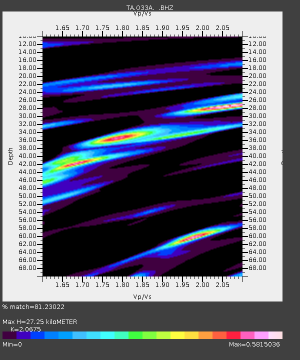
| Arrivals | |
| Ps | 4.6 SECOND |
| PpPs | 13 SECOND |
| PsPs/PpSs | 17 SECOND |

