DRV Dumont d'Urville, Terre Adelie (Antartica) - Earthquake Result Viewer
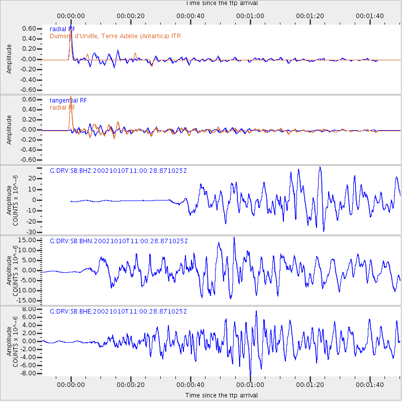
Earthquake location: Irian Jaya Region, Indonesia
Earthquake latitude/longitude: -1.8/134.3
Earthquake time(UTC): 2002/10/10 (283) 10:50:20 GMT
Earthquake Depth: 10 km
Earthquake Magnitude: 6.5 MB, 7.7 MS, 7.6 MW, 7.4 MW
Earthquake Catalog/Contributor: WHDF/NEIC
Network: G GEOSCOPE
Station: DRV Dumont d'Urville, Terre Adelie (Antartica)
Lat/Lon: 66.67 S/140.01 E
Elevation: 40 m
Distance: 64.9 deg
Az: 177.49 deg
Baz: 353.692 deg
Ray Param: 0.05862216
Estimated Moho Depth: 42.0 km
Estimated Crust Vp/Vs: 2.10
Assumed Crust Vp: 6.39 km/s
Estimated Crust Vs: 3.046 km/s
Estimated Crust Poisson's Ratio: 0.35
Radial Match: 97.61408 %
Radial Bump: 393
Transverse Match: 91.18713 %
Transverse Bump: 400
SOD ConfigId: 4714
Insert Time: 2010-02-26 22:08:16.562 +0000
GWidth: 2.5
Max Bumps: 400
Tol: 0.001

Signal To Noise

ChannelStoNSTALTA
G:DRV:SB:BHN:20021010T11:00:28.871025Z2.9301644.7895907E-71.6345811E-7
G:DRV:SB:BHE:20021010T11:00:28.871025Z0.51092921.4981005E-72.9321097E-7
G:DRV:SB:BHZ:20021010T11:00:28.871025Z2.28923449.329619E-74.0754315E-7
Arrivals
Ps7.5 SECOND
PpPs20 SECOND
PsPs/PpSs27 SECOND