S37A Fort Scott, KS, USA - Earthquake Result Viewer
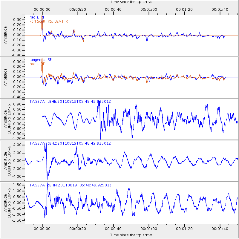
Earthquake location: Near East Coast Of Honshu, Japan
Earthquake latitude/longitude: 37.7/141.7
Earthquake time(UTC): 2011/08/19 (231) 05:36:33 GMT
Earthquake Depth: 47 km
Earthquake Magnitude: 6.3 MB, 5.9 MS, 6.3 MW, 6.3 MW
Earthquake Catalog/Contributor: WHDF/NEIC
Network: TA USArray Transportable Network (new EarthScope stations)
Station: S37A Fort Scott, KS, USA
Lat/Lon: 37.76 N/94.83 W
Elevation: 260 m
Distance: 88.6 deg
Az: 41.372 deg
Baz: 318.568 deg
Ray Param: 0.042362083
Estimated Moho Depth: 23.25 km
Estimated Crust Vp/Vs: 2.08
Assumed Crust Vp: 6.53 km/s
Estimated Crust Vs: 3.136 km/s
Estimated Crust Poisson's Ratio: 0.35
Radial Match: 83.24126 %
Radial Bump: 400
Transverse Match: 84.30105 %
Transverse Bump: 399
SOD ConfigId: 410809
Insert Time: 2012-01-06 09:20:08.228 +0000
GWidth: 2.5
Max Bumps: 400
Tol: 0.001

Signal To Noise

ChannelStoNSTALTA
TA:S37A: :BHZ:20110819T05:48:49.92501Z4.4422932.559692E-65.7620963E-7
TA:S37A: :BHN:20110819T05:48:49.92501Z1.71806787.066744E-74.1131932E-7
TA:S37A: :BHE:20110819T05:48:49.92501Z2.30065426.037946E-72.6244473E-7
Arrivals
Ps3.9 SECOND
PpPs11 SECOND
PsPs/PpSs15 SECOND