K33A Hardington, NE, USA - Earthquake Result Viewer
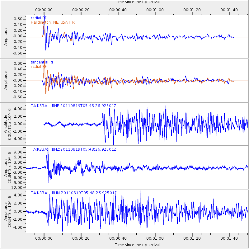
Earthquake location: Near East Coast Of Honshu, Japan
Earthquake latitude/longitude: 37.7/141.7
Earthquake time(UTC): 2011/08/19 (231) 05:36:33 GMT
Earthquake Depth: 47 km
Earthquake Magnitude: 6.3 MB, 5.9 MS, 6.3 MW, 6.3 MW
Earthquake Catalog/Contributor: WHDF/NEIC
Network: TA USArray Transportable Network (new EarthScope stations)
Station: K33A Hardington, NE, USA
Lat/Lon: 42.61 N/97.00 W
Elevation: 507 m
Distance: 83.9 deg
Az: 39.352 deg
Baz: 317.039 deg
Ray Param: 0.04575771
Estimated Moho Depth: 65.75 km
Estimated Crust Vp/Vs: 1.76
Assumed Crust Vp: 6.498 km/s
Estimated Crust Vs: 3.692 km/s
Estimated Crust Poisson's Ratio: 0.26
Radial Match: 87.41906 %
Radial Bump: 400
Transverse Match: 75.492134 %
Transverse Bump: 400
SOD ConfigId: 410809
Insert Time: 2012-01-06 09:20:27.372 +0000
GWidth: 2.5
Max Bumps: 400
Tol: 0.001

Signal To Noise

ChannelStoNSTALTA
TA:K33A: :BHZ:20110819T05:48:26.92501Z18.7517364.176554E-62.2272891E-7
TA:K33A: :BHN:20110819T05:48:26.92501Z8.1007041.5798324E-61.9502409E-7
TA:K33A: :BHE:20110819T05:48:26.92501Z6.8117071.7229587E-62.5294082E-7
Arrivals
Ps7.9 SECOND
PpPs27 SECOND
PsPs/PpSs35 SECOND