O03D Paynes Creek, CA, USA - Earthquake Result Viewer
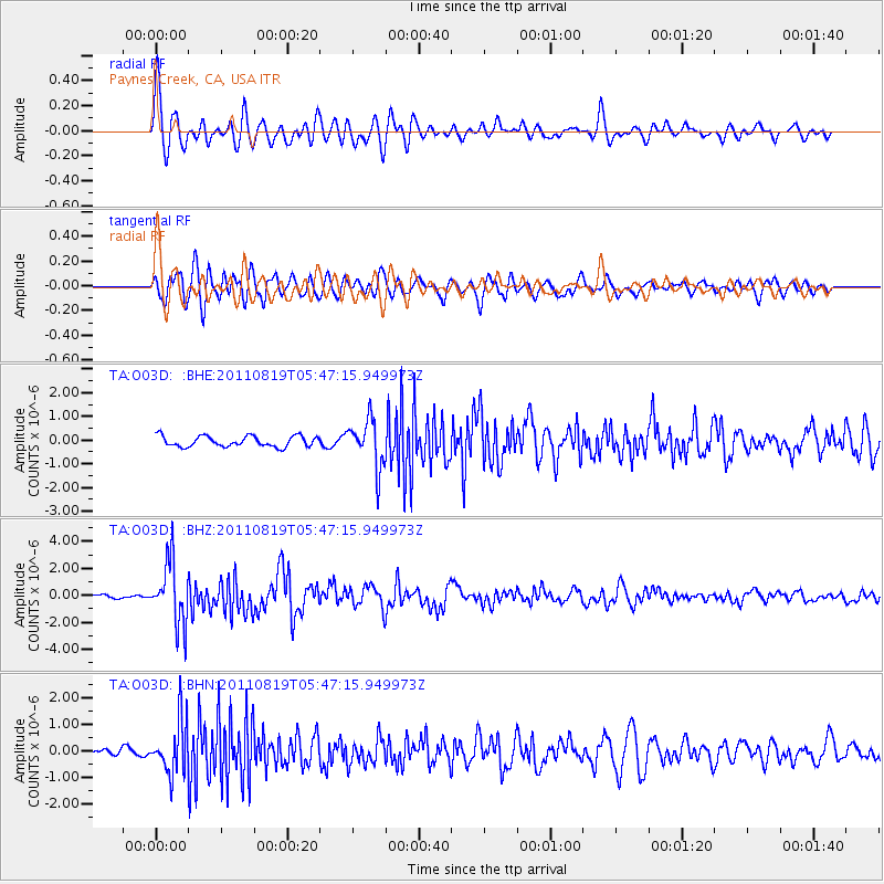
Earthquake location: Near East Coast Of Honshu, Japan
Earthquake latitude/longitude: 37.7/141.7
Earthquake time(UTC): 2011/08/19 (231) 05:36:33 GMT
Earthquake Depth: 47 km
Earthquake Magnitude: 6.3 MB, 5.9 MS, 6.3 MW, 6.3 MW
Earthquake Catalog/Contributor: WHDF/NEIC
Network: TA USArray Transportable Network (new EarthScope stations)
Station: O03D Paynes Creek, CA, USA
Lat/Lon: 40.29 N/121.80 W
Elevation: 968 m
Distance: 71.2 deg
Az: 53.405 deg
Baz: 303.598 deg
Ray Param: 0.054420155
Estimated Moho Depth: 62.0 km
Estimated Crust Vp/Vs: 1.73
Assumed Crust Vp: 6.566 km/s
Estimated Crust Vs: 3.79 km/s
Estimated Crust Poisson's Ratio: 0.25
Radial Match: 84.2057 %
Radial Bump: 400
Transverse Match: 78.983055 %
Transverse Bump: 400
SOD ConfigId: 410809
Insert Time: 2012-01-06 09:22:47.094 +0000
GWidth: 2.5
Max Bumps: 400
Tol: 0.001

Signal To Noise

ChannelStoNSTALTA
TA:O03D: :BHZ:20110819T05:47:15.949973Z13.6337052.2912823E-61.6806013E-7
TA:O03D: :BHN:20110819T05:47:15.949973Z12.0647949.910872E-78.214705E-8
TA:O03D: :BHE:20110819T05:47:15.949973Z4.4926251.0135137E-62.25595E-7
Arrivals
Ps7.2 SECOND
PpPs25 SECOND
PsPs/PpSs32 SECOND