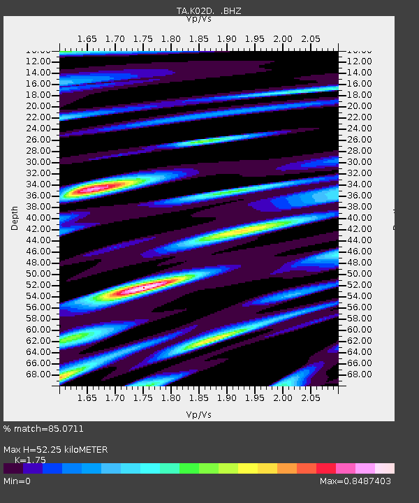
K02D Willamette Meridian, OR, USA - Earthquake Result Viewer
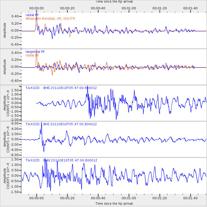
Earthquake location: Near East Coast Of Honshu, Japan
Earthquake latitude/longitude: 37.7/141.7
Earthquake time(UTC): 2011/08/19 (231) 05:36:33 GMT
Earthquake Depth: 47 km
Earthquake Magnitude: 6.3 MB, 5.9 MS, 6.3 MW, 6.3 MW
Earthquake Catalog/Contributor: WHDF/NEIC
Network: TA USArray Transportable Network (new EarthScope stations)
Station: K02D Willamette Meridian, OR, USA
Lat/Lon: 42.70 N/123.67 W
Elevation: 989 m
Distance: 68.7 deg
Az: 52.064 deg
Baz: 301.908 deg
Ray Param: 0.05604726
Estimated Moho Depth: 52.25 km
Estimated Crust Vp/Vs: 1.75
Assumed Crust Vp: 6.522 km/s
Estimated Crust Vs: 3.727 km/s
Estimated Crust Poisson's Ratio: 0.26
Radial Match: 85.0711 %
Radial Bump: 400
Transverse Match: 70.88845 %
Transverse Bump: 400
SOD ConfigId: 410809
Insert Time: 2012-01-06 09:22:49.690 +0000
GWidth: 2.5
Max Bumps: 400
Tol: 0.001

Signal To Noise

ChannelStoNSTALTA
TA:K02D: :BHZ:20110819T05:47:00.80001Z14.3962162.3223834E-61.6131901E-7
TA:K02D: :BHN:20110819T05:47:00.80001Z3.08683445.339323E-71.7297083E-7
TA:K02D: :BHE:20110819T05:47:00.80001Z3.2262277.4717593E-72.3159434E-7
Arrivals
Ps6.3 SECOND
PpPs21 SECOND
PsPs/PpSs27 SECOND