H04D Lebanon, OR, USA - Earthquake Result Viewer
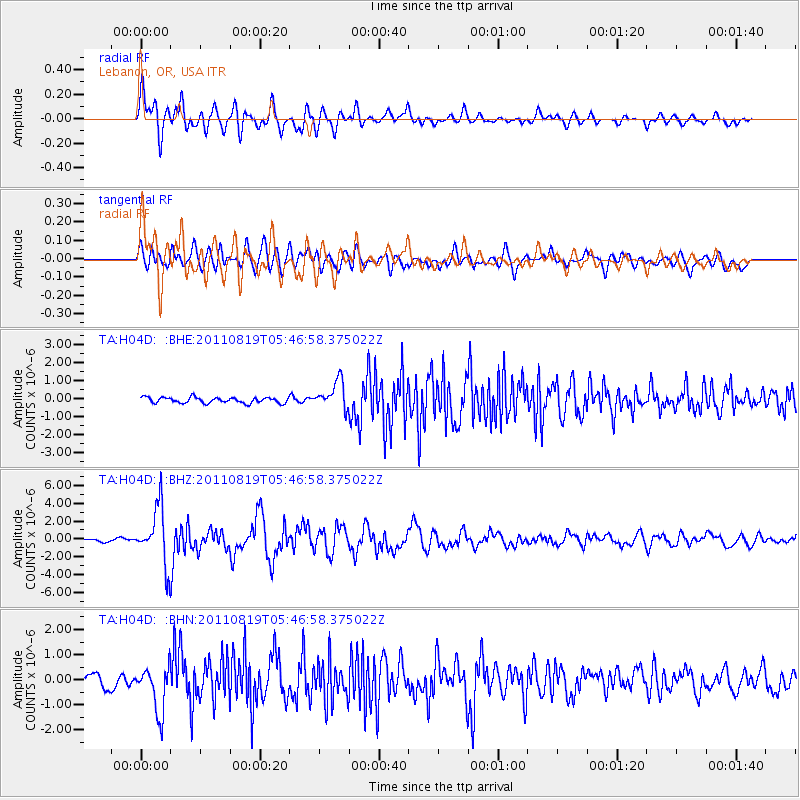
Earthquake location: Near East Coast Of Honshu, Japan
Earthquake latitude/longitude: 37.7/141.7
Earthquake time(UTC): 2011/08/19 (231) 05:36:33 GMT
Earthquake Depth: 47 km
Earthquake Magnitude: 6.3 MB, 5.9 MS, 6.3 MW, 6.3 MW
Earthquake Catalog/Contributor: WHDF/NEIC
Network: TA USArray Transportable Network (new EarthScope stations)
Station: H04D Lebanon, OR, USA
Lat/Lon: 44.52 N/122.74 W
Elevation: 284 m
Distance: 68.3 deg
Az: 50.013 deg
Baz: 301.793 deg
Ray Param: 0.056303144
Estimated Moho Depth: 15.75 km
Estimated Crust Vp/Vs: 2.00
Assumed Crust Vp: 6.566 km/s
Estimated Crust Vs: 3.291 km/s
Estimated Crust Poisson's Ratio: 0.33
Radial Match: 86.919266 %
Radial Bump: 400
Transverse Match: 69.50638 %
Transverse Bump: 400
SOD ConfigId: 410809
Insert Time: 2012-01-06 09:23:35.017 +0000
GWidth: 2.5
Max Bumps: 400
Tol: 0.001

Signal To Noise

ChannelStoNSTALTA
TA:H04D: :BHZ:20110819T05:46:58.375022Z20.1263033.1789784E-61.5795143E-7
TA:H04D: :BHN:20110819T05:46:58.375022Z3.86811269.221013E-72.3838534E-7
TA:H04D: :BHE:20110819T05:46:58.375022Z4.8715767.595318E-71.5591091E-7
Arrivals
Ps2.5 SECOND
PpPs6.9 SECOND
PsPs/PpSs9.4 SECOND