A04D Lummi Island, WA, USA - Earthquake Result Viewer
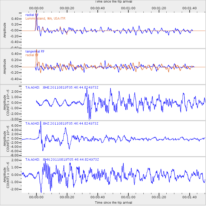
Earthquake location: Near East Coast Of Honshu, Japan
Earthquake latitude/longitude: 37.7/141.7
Earthquake time(UTC): 2011/08/19 (231) 05:36:33 GMT
Earthquake Depth: 47 km
Earthquake Magnitude: 6.3 MB, 5.9 MS, 6.3 MW, 6.3 MW
Earthquake Catalog/Contributor: WHDF/NEIC
Network: TA USArray Transportable Network (new EarthScope stations)
Station: A04D Lummi Island, WA, USA
Lat/Lon: 48.72 N/122.71 W
Elevation: 13 m
Distance: 66.2 deg
Az: 46.1 deg
Baz: 300.301 deg
Ray Param: 0.05770947
Estimated Moho Depth: 40.25 km
Estimated Crust Vp/Vs: 1.65
Assumed Crust Vp: 6.566 km/s
Estimated Crust Vs: 3.967 km/s
Estimated Crust Poisson's Ratio: 0.21
Radial Match: 91.288666 %
Radial Bump: 400
Transverse Match: 67.70073 %
Transverse Bump: 400
SOD ConfigId: 410809
Insert Time: 2012-01-06 09:24:10.640 +0000
GWidth: 2.5
Max Bumps: 400
Tol: 0.001

Signal To Noise

ChannelStoNSTALTA
TA:A04D: :BHZ:20110819T05:46:44.824973Z8.6414133.1585487E-63.6551302E-7
TA:A04D: :BHN:20110819T05:46:44.824973Z1.85470339.190775E-74.955388E-7
TA:A04D: :BHE:20110819T05:46:44.824973Z3.22804361.2336267E-63.8215924E-7
Arrivals
Ps4.2 SECOND
PpPs16 SECOND
PsPs/PpSs20 SECOND