You are here: Home > Network List > TA - USArray Transportable Network (new EarthScope stations) Stations List
> Station D34A Park Rapids, MN, USA > Earthquake Result Viewer
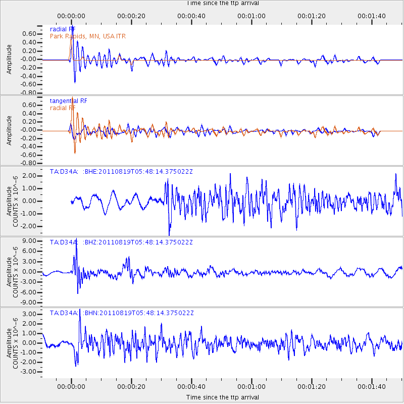
D34A Park Rapids, MN, USA - Earthquake Result Viewer
*The percent match for this event was below the threshold and hence no stack was calculated.
| Earthquake location: |
Near East Coast Of Honshu, Japan |
| Earthquake latitude/longitude: |
37.7/141.7 |
| Earthquake time(UTC): |
2011/08/19 (231) 05:36:33 GMT |
| Earthquake Depth: |
47 km |
| Earthquake Magnitude: |
6.3 MB, 5.9 MS, 6.3 MW, 6.3 MW |
| Earthquake Catalog/Contributor: |
WHDF/NEIC |
|
| Network: |
TA USArray Transportable Network (new EarthScope stations) |
| Station: |
D34A Park Rapids, MN, USA |
| Lat/Lon: |
47.09 N/95.20 W |
| Elevation: |
476 m |
|
| Distance: |
81.5 deg |
| Az: |
35.343 deg |
| Baz: |
317.801 deg |
| Ray Param: |
$rayparam |
*The percent match for this event was below the threshold and hence was not used in the summary stack. |
|
| Radial Match: |
73.19532 % |
| Radial Bump: |
400 |
| Transverse Match: |
63.401115 % |
| Transverse Bump: |
400 |
| SOD ConfigId: |
410809 |
| Insert Time: |
2012-01-06 09:26:03.184 +0000 |
| GWidth: |
2.5 |
| Max Bumps: |
400 |
| Tol: |
0.001 |
|
Signal To Noise
| Channel | StoN | STA | LTA |
| TA:D34A: :BHZ:20110819T05:48:14.375022Z | 5.9708066 | 2.9909481E-6 | 5.0092865E-7 |
| TA:D34A: :BHN:20110819T05:48:14.375022Z | 2.438234 | 1.2957739E-6 | 5.314395E-7 |
| TA:D34A: :BHE:20110819T05:48:14.375022Z | 2.3297875 | 9.967815E-7 | 4.2784222E-7 |
| Arrivals |
| Ps | |
| PpPs | |
| PsPs/PpSs | |


