
E04D Cinebar, WA, USA - Earthquake Result Viewer
| ||||||||||||||||||
| ||||||||||||||||||
| ||||||||||||||||||
|
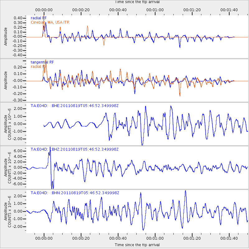
Signal To Noise
| Channel | StoN | STA | LTA |
| TA:E04D: :BHZ:20110819T05:46:52.349998Z | 20.839909 | 3.7523546E-6 | 1.800562E-7 |
| TA:E04D: :BHN:20110819T05:46:52.349998Z | 3.7492332 | 5.5911914E-7 | 1.4912892E-7 |
| TA:E04D: :BHE:20110819T05:46:52.349998Z | 2.5643735 | 7.2583015E-7 | 2.8304387E-7 |
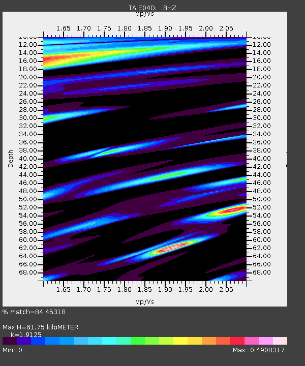
| Arrivals | |
| Ps | 8.9 SECOND |
| PpPs | 26 SECOND |
| PsPs/PpSs | 35 SECOND |

