G32A Webster, SD, USA - Earthquake Result Viewer
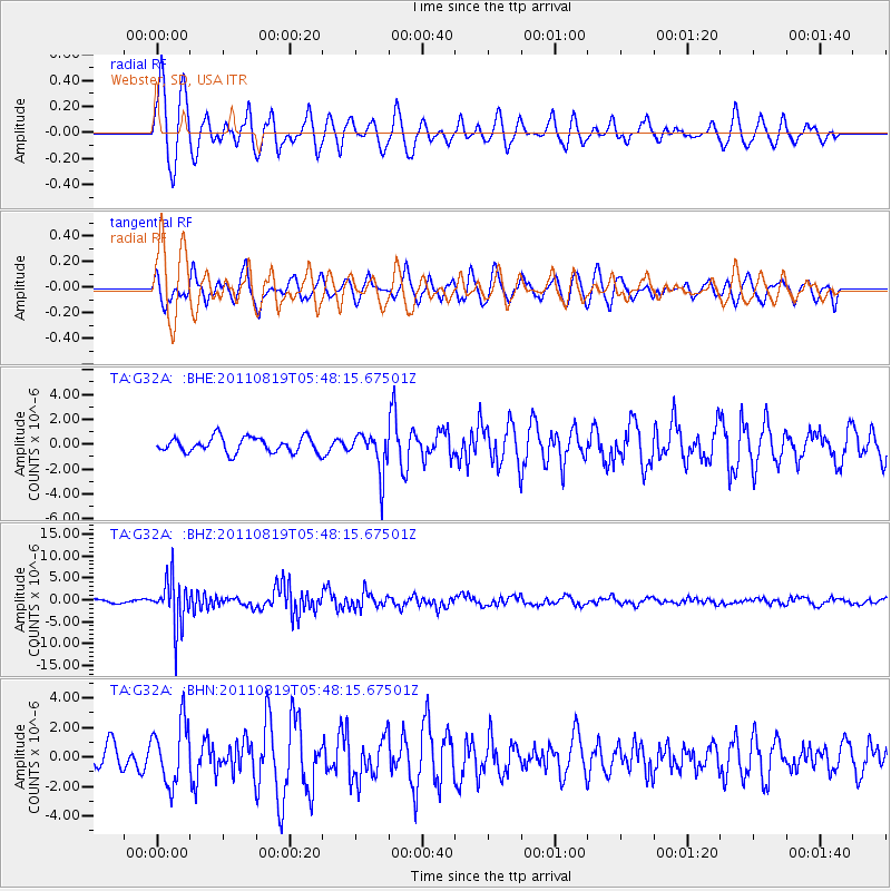
Earthquake location: Near East Coast Of Honshu, Japan
Earthquake latitude/longitude: 37.7/141.7
Earthquake time(UTC): 2011/08/19 (231) 05:36:33 GMT
Earthquake Depth: 47 km
Earthquake Magnitude: 6.3 MB, 5.9 MS, 6.3 MW, 6.3 MW
Earthquake Catalog/Contributor: WHDF/NEIC
Network: TA USArray Transportable Network (new EarthScope stations)
Station: G32A Webster, SD, USA
Lat/Lon: 45.26 N/97.50 W
Elevation: 566 m
Distance: 81.8 deg
Az: 37.787 deg
Baz: 316.499 deg
Ray Param: 0.04728248
Estimated Moho Depth: 12.0 km
Estimated Crust Vp/Vs: 1.60
Assumed Crust Vp: 6.552 km/s
Estimated Crust Vs: 4.089 km/s
Estimated Crust Poisson's Ratio: 0.18
Radial Match: 89.61046 %
Radial Bump: 400
Transverse Match: 75.64656 %
Transverse Bump: 400
SOD ConfigId: 410809
Insert Time: 2012-01-06 09:27:09.737 +0000
GWidth: 2.5
Max Bumps: 400
Tol: 0.001

Signal To Noise

ChannelStoNSTALTA
TA:G32A: :BHZ:20110819T05:48:15.67501Z10.3601715.5273817E-65.335222E-7
TA:G32A: :BHN:20110819T05:48:15.67501Z3.14410332.09581E-66.665844E-7
TA:G32A: :BHE:20110819T05:48:15.67501Z2.65766531.6390246E-66.1671597E-7
Arrivals
Ps1.1 SECOND
PpPs4.6 SECOND
PsPs/PpSs5.8 SECOND