F31A Hecla, SD, USA - Earthquake Result Viewer
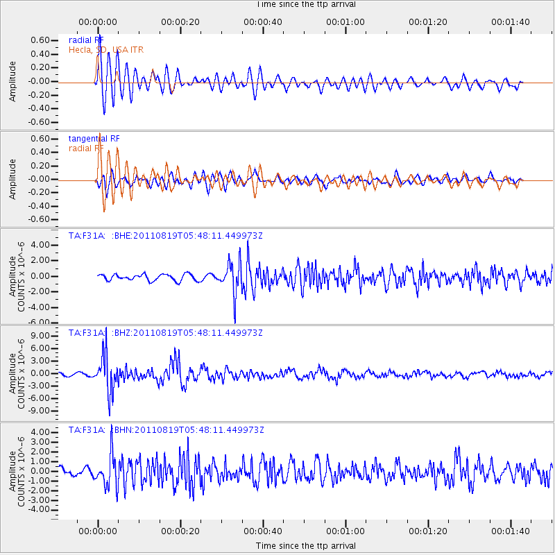
Earthquake location: Near East Coast Of Honshu, Japan
Earthquake latitude/longitude: 37.7/141.7
Earthquake time(UTC): 2011/08/19 (231) 05:36:33 GMT
Earthquake Depth: 47 km
Earthquake Magnitude: 6.3 MB, 5.9 MS, 6.3 MW, 6.3 MW
Earthquake Catalog/Contributor: WHDF/NEIC
Network: TA USArray Transportable Network (new EarthScope stations)
Station: F31A Hecla, SD, USA
Lat/Lon: 45.86 N/98.25 W
Elevation: 412 m
Distance: 81.0 deg
Az: 37.751 deg
Baz: 315.958 deg
Ray Param: 0.04784531
Estimated Moho Depth: 29.25 km
Estimated Crust Vp/Vs: 2.04
Assumed Crust Vp: 6.53 km/s
Estimated Crust Vs: 3.201 km/s
Estimated Crust Poisson's Ratio: 0.34
Radial Match: 84.78839 %
Radial Bump: 400
Transverse Match: 77.11757 %
Transverse Bump: 400
SOD ConfigId: 410809
Insert Time: 2012-01-06 09:27:42.343 +0000
GWidth: 2.5
Max Bumps: 400
Tol: 0.001

Signal To Noise

ChannelStoNSTALTA
TA:F31A: :BHZ:20110819T05:48:11.449973Z13.4163184.396903E-63.27728E-7
TA:F31A: :BHN:20110819T05:48:11.449973Z4.446291.683461E-63.786215E-7
TA:F31A: :BHE:20110819T05:48:11.449973Z4.8556351.970031E-64.0572056E-7
Arrivals
Ps4.8 SECOND
PpPs13 SECOND
PsPs/PpSs18 SECOND