
DRV Dumont d'Urville, Terre Adelie (Antartica) - Earthquake Result Viewer
| ||||||||||||||||||
| ||||||||||||||||||
| ||||||||||||||||||
|
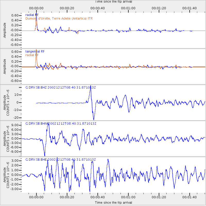
Signal To Noise
| Channel | StoN | STA | LTA |
| G:DRV:SB:BHN:20021212T08:40:31.871013Z | 11.817932 | 1.8343046E-6 | 1.5521368E-7 |
| G:DRV:SB:BHE:20021212T08:40:31.871013Z | 2.6837358 | 5.1252516E-7 | 1.9097453E-7 |
| G:DRV:SB:BHZ:20021212T08:40:31.871013Z | 19.792448 | 3.587959E-6 | 1.8127919E-7 |
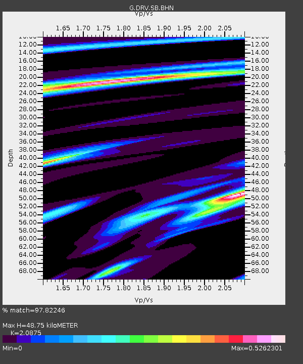
| Arrivals | |
| Ps | 8.6 SECOND |
| PpPs | 23 SECOND |
| PsPs/PpSs | 31 SECOND |

