You are here: Home > Network List > TA - USArray Transportable Network (new EarthScope stations) Stations List
> Station C36A Pine Crest Fram, Angora, MN, USA > Earthquake Result Viewer
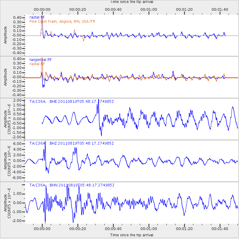
C36A Pine Crest Fram, Angora, MN, USA - Earthquake Result Viewer
*The percent match for this event was below the threshold and hence no stack was calculated.
| Earthquake location: |
Near East Coast Of Honshu, Japan |
| Earthquake latitude/longitude: |
37.7/141.7 |
| Earthquake time(UTC): |
2011/08/19 (231) 05:36:33 GMT |
| Earthquake Depth: |
47 km |
| Earthquake Magnitude: |
6.3 MB, 5.9 MS, 6.3 MW, 6.3 MW |
| Earthquake Catalog/Contributor: |
WHDF/NEIC |
|
| Network: |
TA USArray Transportable Network (new EarthScope stations) |
| Station: |
C36A Pine Crest Fram, Angora, MN, USA |
| Lat/Lon: |
47.76 N/92.84 W |
| Elevation: |
410 m |
|
| Distance: |
82.1 deg |
| Az: |
33.68 deg |
| Baz: |
319.294 deg |
| Ray Param: |
$rayparam |
*The percent match for this event was below the threshold and hence was not used in the summary stack. |
|
| Radial Match: |
69.195625 % |
| Radial Bump: |
400 |
| Transverse Match: |
71.97992 % |
| Transverse Bump: |
378 |
| SOD ConfigId: |
410809 |
| Insert Time: |
2012-01-06 09:28:29.711 +0000 |
| GWidth: |
2.5 |
| Max Bumps: |
400 |
| Tol: |
0.001 |
|
Signal To Noise
| Channel | StoN | STA | LTA |
| TA:C36A: :BHZ:20110819T05:48:17.274985Z | 5.3604302 | 2.6104192E-6 | 4.8697945E-7 |
| TA:C36A: :BHN:20110819T05:48:17.274985Z | 2.137618 | 7.806109E-7 | 3.651779E-7 |
| TA:C36A: :BHE:20110819T05:48:17.274985Z | 2.9373434 | 9.606748E-7 | 3.2705566E-7 |
| Arrivals |
| Ps | |
| PpPs | |
| PsPs/PpSs | |


