P38A Dawn, MO, USA - Earthquake Result Viewer
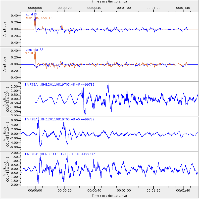
Earthquake location: Near East Coast Of Honshu, Japan
Earthquake latitude/longitude: 37.7/141.7
Earthquake time(UTC): 2011/08/19 (231) 05:36:33 GMT
Earthquake Depth: 47 km
Earthquake Magnitude: 6.3 MB, 5.9 MS, 6.3 MW, 6.3 MW
Earthquake Catalog/Contributor: WHDF/NEIC
Network: TA USArray Transportable Network (new EarthScope stations)
Station: P38A Dawn, MO, USA
Lat/Lon: 39.62 N/93.53 W
Elevation: 248 m
Distance: 87.9 deg
Az: 39.383 deg
Baz: 319.315 deg
Ray Param: 0.042910486
Estimated Moho Depth: 40.0 km
Estimated Crust Vp/Vs: 1.91
Assumed Crust Vp: 6.498 km/s
Estimated Crust Vs: 3.406 km/s
Estimated Crust Poisson's Ratio: 0.31
Radial Match: 86.21527 %
Radial Bump: 390
Transverse Match: 62.054935 %
Transverse Bump: 400
SOD ConfigId: 410809
Insert Time: 2012-01-06 09:32:34.441 +0000
GWidth: 2.5
Max Bumps: 400
Tol: 0.001

Signal To Noise

ChannelStoNSTALTA
TA:P38A: :BHZ:20110819T05:48:46.449973Z7.02691653.3247957E-64.7315143E-7
TA:P38A: :BHN:20110819T05:48:46.449973Z3.3104689.214176E-72.7833454E-7
TA:P38A: :BHE:20110819T05:48:46.449973Z2.88699849.670699E-73.3497415E-7
Arrivals
Ps5.7 SECOND
PpPs18 SECOND
PsPs/PpSs23 SECOND