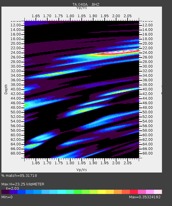
O40A La Belle, MO, USA - Earthquake Result Viewer

Earthquake location: Near East Coast Of Honshu, Japan
Earthquake latitude/longitude: 37.7/141.7
Earthquake time(UTC): 2011/08/19 (231) 05:36:33 GMT
Earthquake Depth: 47 km
Earthquake Magnitude: 6.3 MB, 5.9 MS, 6.3 MW, 6.3 MW
Earthquake Catalog/Contributor: WHDF/NEIC
Network: TA USArray Transportable Network (new EarthScope stations)
Station: O40A La Belle, MO, USA
Lat/Lon: 40.12 N/91.87 W
Elevation: 206 m
Distance: 88.3 deg
Az: 38.088 deg
Baz: 320.331 deg
Ray Param: 0.042580735
Estimated Moho Depth: 23.25 km
Estimated Crust Vp/Vs: 2.03
Assumed Crust Vp: 6.498 km/s
Estimated Crust Vs: 3.201 km/s
Estimated Crust Poisson's Ratio: 0.34
Radial Match: 85.31718 %
Radial Bump: 400
Transverse Match: 69.665474 %
Transverse Bump: 400
SOD ConfigId: 410809
Insert Time: 2012-01-06 09:33:36.953 +0000
GWidth: 2.5
Max Bumps: 400
Tol: 0.001

Signal To Noise

ChannelStoNSTALTA
TA:O40A: :BHZ:20110819T05:48:48.55001Z8.2002443.001571E-63.6603436E-7
TA:O40A: :BHN:20110819T05:48:48.55001Z3.68210366.664372E-71.8099361E-7
TA:O40A: :BHE:20110819T05:48:48.55001Z2.8912975.846289E-72.0220298E-7
Arrivals
Ps3.8 SECOND
PpPs11 SECOND
PsPs/PpSs14 SECOND