W37B Quinton, OK, USA - Earthquake Result Viewer
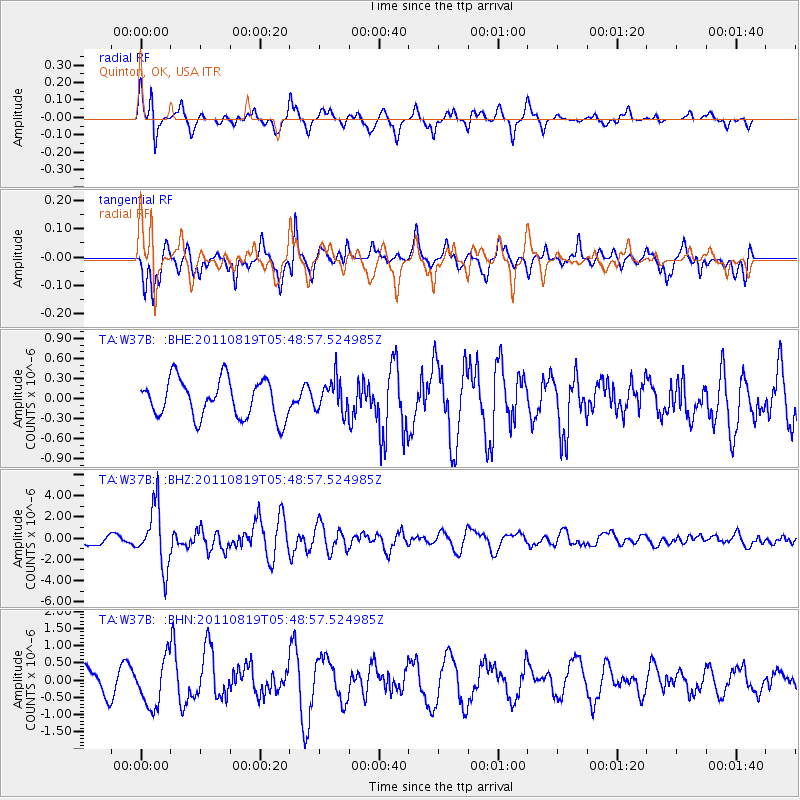
Earthquake location: Near East Coast Of Honshu, Japan
Earthquake latitude/longitude: 37.7/141.7
Earthquake time(UTC): 2011/08/19 (231) 05:36:33 GMT
Earthquake Depth: 47 km
Earthquake Magnitude: 6.3 MB, 5.9 MS, 6.3 MW, 6.3 MW
Earthquake Catalog/Contributor: WHDF/NEIC
Network: TA USArray Transportable Network (new EarthScope stations)
Station: W37B Quinton, OK, USA
Lat/Lon: 35.14 N/95.43 W
Elevation: 279 m
Distance: 90.3 deg
Az: 43.473 deg
Baz: 318.231 deg
Ray Param: 0.04167822
Estimated Moho Depth: 17.25 km
Estimated Crust Vp/Vs: 1.65
Assumed Crust Vp: 6.498 km/s
Estimated Crust Vs: 3.932 km/s
Estimated Crust Poisson's Ratio: 0.21
Radial Match: 87.87766 %
Radial Bump: 364
Transverse Match: 71.836815 %
Transverse Bump: 352
SOD ConfigId: 410809
Insert Time: 2012-01-06 09:34:53.980 +0000
GWidth: 2.5
Max Bumps: 400
Tol: 0.001

Signal To Noise

ChannelStoNSTALTA
TA:W37B: :BHZ:20110819T05:48:57.524985Z5.38435362.8227137E-65.242437E-7
TA:W37B: :BHN:20110819T05:48:57.524985Z1.87195746.909311E-73.6909552E-7
TA:W37B: :BHE:20110819T05:48:57.524985Z0.818910062.3423745E-72.8603563E-7
Arrivals
Ps1.8 SECOND
PpPs6.9 SECOND
PsPs/PpSs8.7 SECOND