You are here: Home > Network List > TA - USArray Transportable Network (new EarthScope stations) Stations List
> Station J39A Decorah, IA, USA > Earthquake Result Viewer
J39A Decorah, IA, USA - Earthquake Result Viewer
*The percent match for this event was below the threshold and hence no stack was calculated.
| Earthquake location: |
Near East Coast Of Honshu, Japan |
| Earthquake latitude/longitude: |
37.7/141.7 |
| Earthquake time(UTC): |
2011/08/19 (231) 05:36:33 GMT |
| Earthquake Depth: |
47 km |
| Earthquake Magnitude: |
6.3 MB, 5.9 MS, 6.3 MW, 6.3 MW |
| Earthquake Catalog/Contributor: |
WHDF/NEIC |
|
| Network: |
TA USArray Transportable Network (new EarthScope stations) |
| Station: |
J39A Decorah, IA, USA |
| Lat/Lon: |
43.34 N/91.71 W |
| Elevation: |
350 m |
|
| Distance: |
86.0 deg |
| Az: |
35.939 deg |
| Baz: |
320.335 deg |
| Ray Param: |
$rayparam |
*The percent match for this event was below the threshold and hence was not used in the summary stack. |
|
| Radial Match: |
75.78975 % |
| Radial Bump: |
400 |
| Transverse Match: |
73.444496 % |
| Transverse Bump: |
400 |
| SOD ConfigId: |
410809 |
| Insert Time: |
2012-01-06 09:43:43.306 +0000 |
| GWidth: |
2.5 |
| Max Bumps: |
400 |
| Tol: |
0.001 |
|
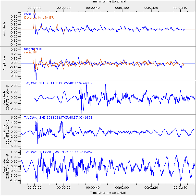
Signal To Noise
| Channel | StoN | STA | LTA |
| TA:J39A: :BHZ:20110819T05:48:37.024985Z | 3.9368002 | 2.5080294E-6 | 6.370731E-7 |
| TA:J39A: :BHN:20110819T05:48:37.024985Z | 1.6097885 | 7.9717086E-7 | 4.9520224E-7 |
| TA:J39A: :BHE:20110819T05:48:37.024985Z | 2.6699083 | 1.0812802E-6 | 4.0498773E-7 |
| Arrivals |
| Ps | |
| PpPs | |
| PsPs/PpSs | |


