
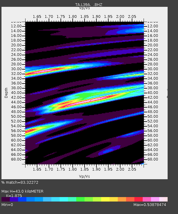
L39A Vinton, IA, USA - Earthquake Result Viewer
| ||||||||||||||||||
| ||||||||||||||||||
| ||||||||||||||||||
|
Signal To Noise
| Channel | StoN | STA | LTA |
| TA:L39A: :BHZ:20110819T05:48:40.875022Z | 9.744937 | 4.45804E-6 | 4.5747245E-7 |
| TA:L39A: :BHN:20110819T05:48:40.875022Z | 2.9063063 | 1.2329573E-6 | 4.2423514E-7 |
| TA:L39A: :BHE:20110819T05:48:40.875022Z | 3.206228 | 1.1114183E-6 | 3.466436E-7 |
| Arrivals | |
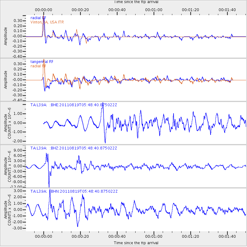
| Ps | 5.9 SECOND |
| PpPs | 19 SECOND |
| PsPs/PpSs | 24 SECOND |

