You are here: Home > Network List > TA - USArray Transportable Network (new EarthScope stations) Stations List
> Station O42A Bath, IL, USA > Earthquake Result Viewer
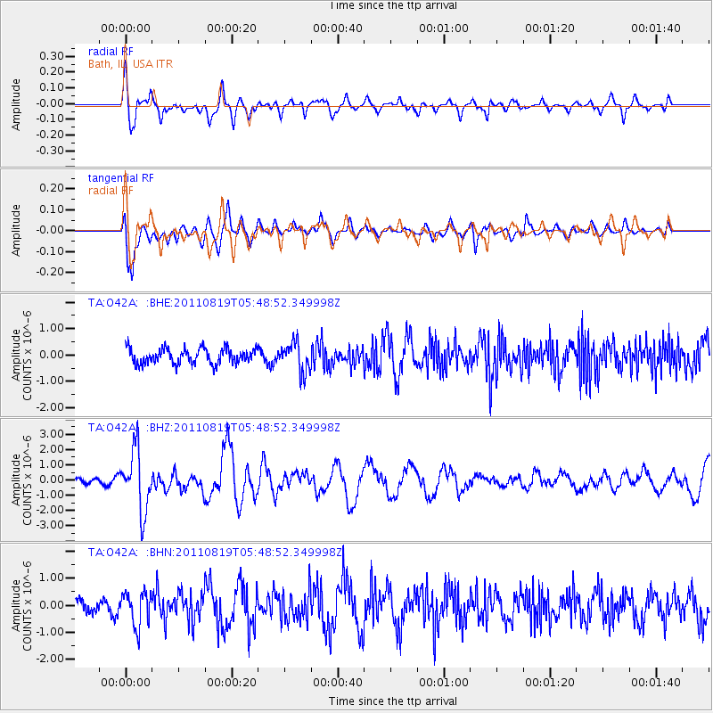
O42A Bath, IL, USA - Earthquake Result Viewer
*The percent match for this event was below the threshold and hence no stack was calculated.
| Earthquake location: |
Near East Coast Of Honshu, Japan |
| Earthquake latitude/longitude: |
37.7/141.7 |
| Earthquake time(UTC): |
2011/08/19 (231) 05:36:33 GMT |
| Earthquake Depth: |
47 km |
| Earthquake Magnitude: |
6.3 MB, 5.9 MS, 6.3 MW, 6.3 MW |
| Earthquake Catalog/Contributor: |
WHDF/NEIC |
|
| Network: |
TA USArray Transportable Network (new EarthScope stations) |
| Station: |
O42A Bath, IL, USA |
| Lat/Lon: |
40.20 N/90.08 W |
| Elevation: |
155 m |
|
| Distance: |
89.2 deg |
| Az: |
36.975 deg |
| Baz: |
321.458 deg |
| Ray Param: |
$rayparam |
*The percent match for this event was below the threshold and hence was not used in the summary stack. |
|
| Radial Match: |
71.569534 % |
| Radial Bump: |
400 |
| Transverse Match: |
63.383553 % |
| Transverse Bump: |
400 |
| SOD ConfigId: |
410809 |
| Insert Time: |
2012-01-06 09:43:59.282 +0000 |
| GWidth: |
2.5 |
| Max Bumps: |
400 |
| Tol: |
0.001 |
|
Signal To Noise
| Channel | StoN | STA | LTA |
| TA:O42A: :BHZ:20110819T05:48:52.349998Z | 2.7290165 | 2.0267557E-6 | 7.4266893E-7 |
| TA:O42A: :BHN:20110819T05:48:52.349998Z | 1.1186453 | 6.3230664E-7 | 5.6524317E-7 |
| TA:O42A: :BHE:20110819T05:48:52.349998Z | 2.000004 | 5.688891E-7 | 2.8444398E-7 |
| Arrivals |
| Ps | |
| PpPs | |
| PsPs/PpSs | |


