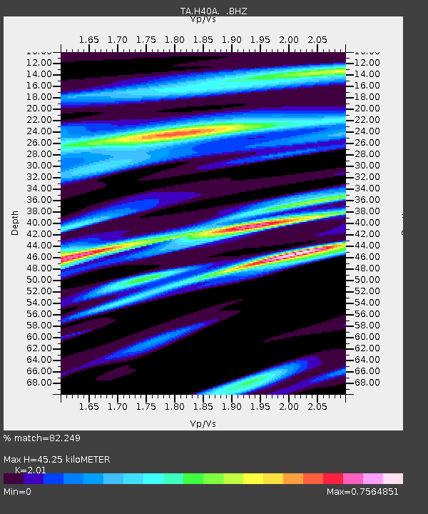
H40A Chili, WI, USA - Earthquake Result Viewer
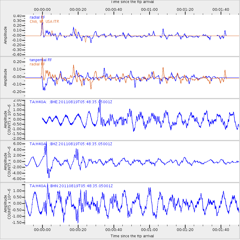
Earthquake location: Near East Coast Of Honshu, Japan
Earthquake latitude/longitude: 37.7/141.7
Earthquake time(UTC): 2011/08/19 (231) 05:36:33 GMT
Earthquake Depth: 47 km
Earthquake Magnitude: 6.3 MB, 5.9 MS, 6.3 MW, 6.3 MW
Earthquake Catalog/Contributor: WHDF/NEIC
Network: TA USArray Transportable Network (new EarthScope stations)
Station: H40A Chili, WI, USA
Lat/Lon: 44.62 N/90.39 W
Elevation: 372 m
Distance: 85.6 deg
Az: 34.385 deg
Baz: 321.131 deg
Ray Param: 0.044602025
Estimated Moho Depth: 45.25 km
Estimated Crust Vp/Vs: 2.01
Assumed Crust Vp: 6.571 km/s
Estimated Crust Vs: 3.269 km/s
Estimated Crust Poisson's Ratio: 0.34
Radial Match: 82.249 %
Radial Bump: 400
Transverse Match: 79.28141 %
Transverse Bump: 400
SOD ConfigId: 410809
Insert Time: 2012-01-06 09:46:19.458 +0000
GWidth: 2.5
Max Bumps: 400
Tol: 0.001

Signal To Noise

ChannelStoNSTALTA
TA:H40A: :BHZ:20110819T05:48:35.05001Z4.80699163.2325645E-66.724714E-7
TA:H40A: :BHN:20110819T05:48:35.05001Z1.65635296.192767E-73.7387971E-7
TA:H40A: :BHE:20110819T05:48:35.05001Z2.2062667.398862E-73.3535676E-7
Arrivals
Ps7.1 SECOND
PpPs20 SECOND
PsPs/PpSs27 SECOND