NEE2 Needles Airport - Earthquake Result Viewer
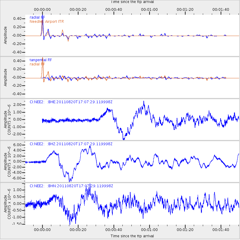
Earthquake location: Vanuatu Islands
Earthquake latitude/longitude: -18.4/168.1
Earthquake time(UTC): 2011/08/20 (232) 16:55:02 GMT
Earthquake Depth: 32 km
Earthquake Magnitude: 6.2 MB, 7.1 MS, 7.1 MW, 7.0 MW
Earthquake Catalog/Contributor: WHDF/NEIC
Network: CI Caltech Regional Seismic Network
Station: NEE2 Needles Airport
Lat/Lon: 34.77 N/114.62 W
Elevation: 271 m
Distance: 90.3 deg
Az: 53.411 deg
Baz: 247.857 deg
Ray Param: 0.041680124
Estimated Moho Depth: 26.0 km
Estimated Crust Vp/Vs: 1.78
Assumed Crust Vp: 6.276 km/s
Estimated Crust Vs: 3.521 km/s
Estimated Crust Poisson's Ratio: 0.27
Radial Match: 95.11382 %
Radial Bump: 286
Transverse Match: 81.292015 %
Transverse Bump: 400
SOD ConfigId: 414626
Insert Time: 2012-01-13 05:04:23.117 +0000
GWidth: 2.5
Max Bumps: 400
Tol: 0.001

Signal To Noise

ChannelStoNSTALTA
CI:NEE2: :BHZ:20110820T17:07:29.119998Z9.7525411.400876E-61.4364215E-7
CI:NEE2: :BHN:20110820T17:07:29.119998Z1.3676981.8645868E-71.363303E-7
CI:NEE2: :BHE:20110820T17:07:29.119998Z3.68123964.638689E-71.260089E-7
Arrivals
Ps3.3 SECOND
PpPs11 SECOND
PsPs/PpSs15 SECOND