You are here: Home > Network List > TA - USArray Transportable Network (new EarthScope stations) Stations List
> Station Y12C Blythe, CA, USA > Earthquake Result Viewer
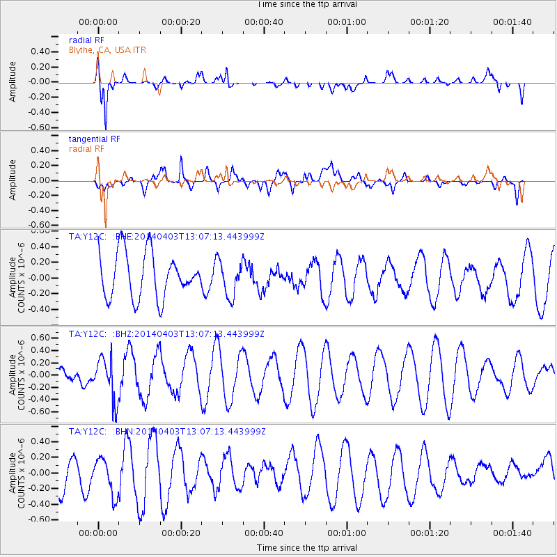
Y12C Blythe, CA, USA - Earthquake Result Viewer
*The percent match for this event was below the threshold and hence no stack was calculated.
| Earthquake location: |
Fiji Islands Region |
| Earthquake latitude/longitude: |
-18.0/-178.4 |
| Earthquake time(UTC): |
2014/04/03 (093) 12:56:36 GMT |
| Earthquake Depth: |
579 km |
| Earthquake Magnitude: |
5.3 mb |
| Earthquake Catalog/Contributor: |
ISC/ISC |
|
| Network: |
TA USArray Transportable Network (new EarthScope stations) |
| Station: |
Y12C Blythe, CA, USA |
| Lat/Lon: |
33.75 N/114.52 W |
| Elevation: |
196 m |
|
| Distance: |
79.7 deg |
| Az: |
49.475 deg |
| Baz: |
240.234 deg |
| Ray Param: |
$rayparam |
*The percent match for this event was below the threshold and hence was not used in the summary stack. |
|
| Radial Match: |
82.91368 % |
| Radial Bump: |
400 |
| Transverse Match: |
53.816307 % |
| Transverse Bump: |
400 |
| SOD ConfigId: |
3390531 |
| Insert Time: |
2019-04-11 03:27:43.910 +0000 |
| GWidth: |
2.5 |
| Max Bumps: |
400 |
| Tol: |
0.001 |
|
Signal To Noise
| Channel | StoN | STA | LTA |
| TA:Y12C: :BHZ:20140403T13:07:13.443999Z | 2.0987782 | 3.6131888E-7 | 1.7215676E-7 |
| TA:Y12C: :BHN:20140403T13:07:13.443999Z | 1.0495064 | 2.5768895E-7 | 2.4553347E-7 |
| TA:Y12C: :BHE:20140403T13:07:13.443999Z | 0.77249575 | 2.2102647E-7 | 2.8611998E-7 |
| Arrivals |
| Ps | |
| PpPs | |
| PsPs/PpSs | |


