You are here: Home > Network List > UW - Pacific Northwest Regional Seismic Network Stations List
> Station MRBL Marblemount, WA, USA > Earthquake Result Viewer
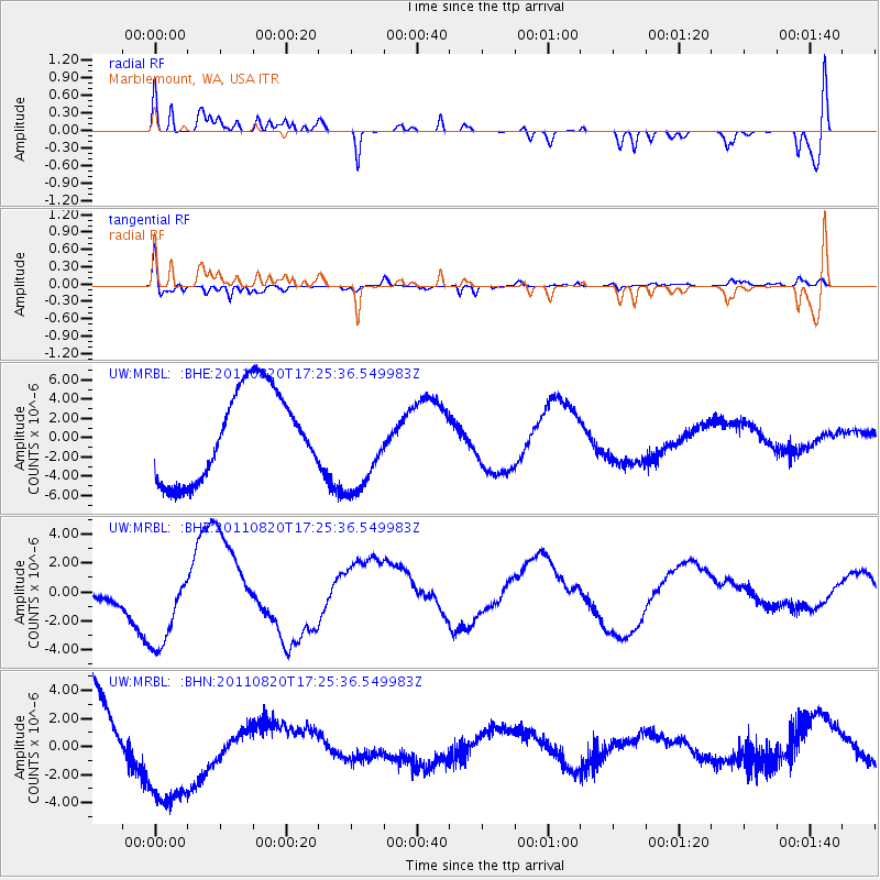
MRBL Marblemount, WA, USA - Earthquake Result Viewer
*The percent match for this event was below the threshold and hence no stack was calculated.
| Earthquake location: |
Vanuatu Islands |
| Earthquake latitude/longitude: |
-18.3/168.2 |
| Earthquake time(UTC): |
2011/08/20 (232) 17:13:06 GMT |
| Earthquake Depth: |
35 km |
| Earthquake Magnitude: |
5.9 MB, 6.5 MW |
| Earthquake Catalog/Contributor: |
WHDF/NEIC |
|
| Network: |
UW Pacific Northwest Regional Seismic Network |
| Station: |
MRBL Marblemount, WA, USA |
| Lat/Lon: |
48.52 N/121.48 W |
| Elevation: |
75 m |
|
| Distance: |
91.2 deg |
| Az: |
38.78 deg |
| Baz: |
243.5 deg |
| Ray Param: |
$rayparam |
*The percent match for this event was below the threshold and hence was not used in the summary stack. |
|
| Radial Match: |
37.875412 % |
| Radial Bump: |
318 |
| Transverse Match: |
69.57791 % |
| Transverse Bump: |
273 |
| SOD ConfigId: |
414626 |
| Insert Time: |
2012-01-13 05:22:56.484 +0000 |
| GWidth: |
2.5 |
| Max Bumps: |
400 |
| Tol: |
0.001 |
|
Signal To Noise
| Channel | StoN | STA | LTA |
| UW:MRBL: :BHZ:20110820T17:25:36.549983Z | 2.9022741 | 3.3535548E-6 | 1.1554921E-6 |
| UW:MRBL: :BHN:20110820T17:25:36.549983Z | 0.7588944 | 3.6010933E-6 | 4.745184E-6 |
| UW:MRBL: :BHE:20110820T17:25:36.549983Z | 1.0663754 | 4.884388E-6 | 4.5803645E-6 |
| Arrivals |
| Ps | |
| PpPs | |
| PsPs/PpSs | |


